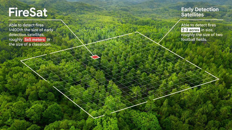
Google has partnered with the Earth Fire Alliance, Muon Space, and the Environmental Defense Fund to launch FireSat, a new satellite constellation designed to detect wildfires as small as 5×5 meters within 20 minutes. This cutting-edge technology addresses the limitations of current satellite systems, which often miss early-stage fires due to low-resolution images and infrequent updates. FireSat’s AI-powered infrared sensors compare real-time satellite images with past data to identify small-scale fires quickly and alert authorities, taking into account nearby infrastructure and weather conditions.
With $13 million in funding from Google.org and additional support from the Moore Foundation, FireSat is set to revolutionize how firefighters and emergency responders manage wildfires. The system will provide global, near real-time data on wildfire size, location, and intensity, enabling faster and more effective responses. Controlled burns have been used to test and fine-tune the detection model.
Beyond immediate response, FireSat will contribute to wildfire research by creating a detailed historical record of fires, helping scientists model fire behavior. This initiative ties into Google’s ongoing work, including its partnership with the U.S. Forest Service on fire simulations and the release of FireBench, an open-source dataset for wildfire research. FireSat reflects Google’s broader commitment to using technology to address climate challenges.


