The Municipality of Genoa has completed a landmark pilot project to create a city-wide digital twin covering both surface and subsurface assets, enabling advanced hydrogeological risk simulation and infrastructure management. The initiative, realised in partnership with the START 4.0 competence centre and the Swedish multinational Hexagon AB, mapped four strategic areas of Genoa’s historic centre and Valpolcevera using high-precision surveying and georadar technologies.
Project Overview and Use-Cases
The mapping campaign targeted four critical zones including Via delle Tofane in Valpolcevera, noted for its complex network of underground utilities. Among the technologies employed were static 3 D laser scanning, vehicle/mobile mapping, LiDAR drones inside confined underground streams, and ground-penetrating radar (GPR) to depths of approximately three metres.
On the surface side, building façades, road surfaces, manholes, signage and street-furniture were captured with millimetric accuracy. Beneath ground, the georadar work mapped hydraulic conduits and vaults of underground streams, identifying hidden structures and potential interference elements.
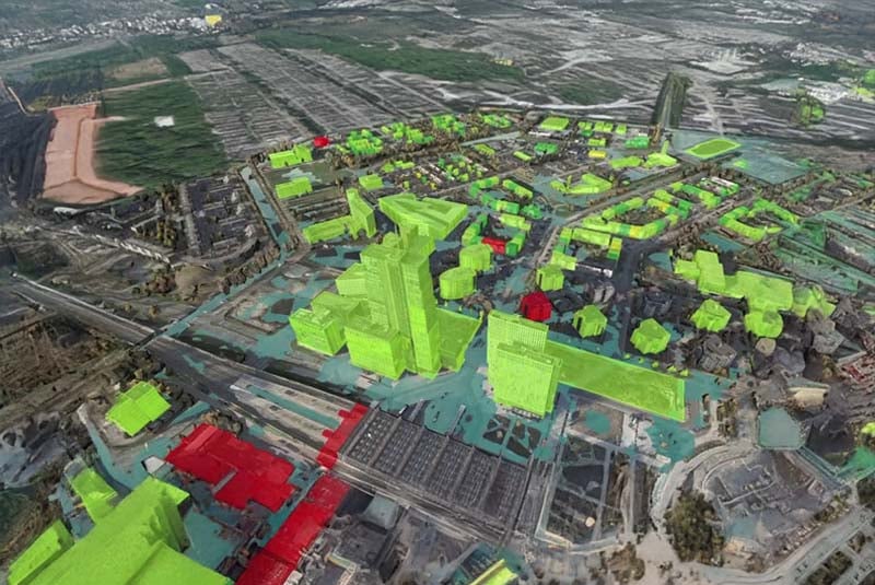
All captured data flows into Hexagon’s urban digital twin framework, specifically the “HxGN Smart Sites” platform, configured and integrated for the municipality by START 4.0. This unified environment supports simulation, maintenance planning, predictive risk management and real-time monitoring for networks, buildings and infrastructure.
Strategic Significance and Flood Prevention
Genoa, situated in the Liguria region, faces frequent hydraulic and hydrogeological threats due to its topography, dense historic fabric and complex underground watercourses. The digital twin project is explicitly aimed at strengthening the city’s capacity to anticipate vulnerabilities, simulate flooding or subsurface collapse scenarios, optimise maintenance regimes and support emergency response.
By bringing surface, subsurface and sensor data into a shared digital environment, the municipality aims to shift from reactive maintenance to proactive lifecycle management. Project documentation describes the goal as “bringing data to life” to support strategic decisions on mobility, public works, infrastructure maintenance and emergency operations.
Next Steps and Scalability
While the pilot covers the four select areas, the municipality positions the project as a “laboratory open to innovation” and anticipates scalability across the city and possibly to other municipalities.
Key questions for the next phase include: how the data-capture workflow will be sustained (e.g., sensor installation, periodic resurveying, IoT connectivity), how interoperability with existing municipal systems (e.g., GIS, asset-management, emergency-response) will be managed, and the business-case for scaling (investment, operations cost, ROI).