 in Barcelona
 3 to 5 Nov 2026
when we think of the german city of cologne what comes to mind is actual cologne with its strong perfumy smells as that is where it was first made in the 18th century but fast forward to 2023 and instead of focusing on what the city did with its eau de cologne or water of cologne Let's focus on what it's doing with another type of water, it's wastewater. The Public Wastewater Authority Management in Cologne is using GeoAI to calculate taxes on wastewater. But before we go into more detail, what is GeoAI? And GeoAI is a new form of machine learning that's based on a geographic component. And that includes the recognition of complex objects in aerial photos in our campus. It's basically bringing AI technology into the geospatial context. So, and what happens and what does it mean in reality? We do take aerial pictures, we do take point clouds coming from LiDAR sensors, and then we start analyzing the imagery and the point cloud with AI technology. GOAI is being used in the water vertical in its management. In Germany, for the calculation of wastewater taxes, cities take into account how much of someone's property is paved and how much is a green area like grass. The more paved the surface is, the more taxes owners have to pay as the water, instead of being absorbed, has to go into the sewage system. The same goes for Cologne's Stab, which calculates wastewater taxes manually, something that demands... many hours and leaves piles of cases left to review. So the company looked for an already made solution to alleviate the workload. That's how they found GeoAI. They decided to test out the solution in a 30 square kilometer area with hexagon which only needed aerial photos of the area in particular which was selected because it had old, new and industrial parts. The only thing you need to do is to calculate the aerial photographs of one year and then calculate the aerial photographs of the next year and then just to compare those two data sets this method can can really detect and recognize complex objects for example like cars and once a car is detected then it's basically classified as concrete because usually a car is on concrete in this method there are different 25 different classes for classifying the surfaces for example concrete or roof or sand or everything which is which is paved which which affects the drainage of the water of the rainwater for the information to be more accurate other types of data can be taken into account and is then used along with the aerial film It also improves the quality of the results if you take LiDAR data into account. There are special sensors, hybrid sensors which collect the photo and the laser scan data at the same time to make it one consistent data set. And if you take also the laser scan data which gives you information about the altitude into account for this method and you also use it for the method then the results can be improved and we are currently working on the process to integrate this data and other necessary data for for the process from other sources into the wastewater management and information system for example we need also to integrate the owner's data we need to integrate data from the catastrophe data and and and other The software is obviously ours from Hexagon, so we do have a special trained system for executing the AI and we do have a software which is called Spatial Modeler, which does the post -processing of the data, so converting Raster to Vector and do the cleanups and these things. The hardware is typically a cloud -based system because for the AI process you need certain computing power, especially with GPUs and make Nordic. executed. And then we hand over to the customer and it's up to the customer to either use Hexagon software for displaying the spatial part, so to display the map, or it's fed into his standard software environment he has. Hexagon estimates that Shterb can save up to 90 % of time with this solution. And that's about like 500 square kilometers. and that costed about a hundred thousand euros. Cologne is looking to use GeoAI to address other use cases like predicting rainwater flow and mitigating flooding risks, but there are other use cases that technology can address. We do have a lot of other use cases and they are all kind of linked to the overarching topic of climate change and sustainability. So... In an Austrian city we are calculating the biomass and the capability of capturing CO2 within the city based on the amount of green which is part of the city which we can calculate out of our GUAI process. With the project Shterb is hoping to catch up with the task of collecting taxes and gathering actionable data that allows them to correctly tax private landowners but enforcing tax collection has also other benefits. as it encourages people to keep their land green which is better for the climate and urban heat management in summer. Don't forget to like, comment and subscribe for more stories like this. I'm Emma Lothano Dugan for Current Insights.
Using GeoAI to Calculate Wastewater Taxes in Cologne
AI & Computer VisionCologneWastewater network monitoringWater
In this video
-
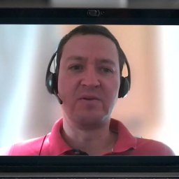 Alexander Schlote
Product Manager GIS, StEB
-
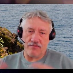 Uwe Jasnoch
Director EMEA government, transportation, defense, Hexagon
About this video
In this informative video, we delve into a unique aspect of urban management in Germany, focusing on the calculation of wastewater taxes in various cities. A key factor that these cities consider is the proportion of a property that is paved compared to areas covered in greenery, such as grass. The rationale behind this approach is straightforward: properties with more paved surfaces contribute more to the runoff water that enters the sewage system, as opposed to being absorbed by the ground. Consequently, owners of such properties are subject to higher wastewater taxes.
We take a closer look at the city of Cologne, where the wastewater management authority, StEB (Stadtentwässerungsbetriebe Köln), is responsible for this taxation process. Traditionally, StEB has been calculating these taxes manually. This conventional method, while effective, is time-consuming and often results in a significant backlog of cases needing review. Faced with the challenge of managing this workload efficiently, StEB embarked on a search for technological solutions.
This quest led them to the realm of geospatial artificial intelligence, commonly referred to as GeoAI. GeoAI represents a fusion of geospatial technology with the advanced capabilities of artificial intelligence, providing innovative solutions for spatial data analysis and management.
In our video, we feature insightful interviews with Alexander Schlote from Cologne's StEB and Dr. Uwe Jasnoch from Hexagon. These experts shed light on the practical application of GeoAI in the context of wastewater tax calculation. They discuss the transformative impact of GeoAI on StEB's operations, highlighting how it streamlines the process, enhances accuracy, and reduces the time spent on manual assessments.
Join us as we explore this intersection of urban management and cutting-edge technology. We aim to provide a comprehensive overview of how GeoAI is being utilized in Cologne for a more efficient and effective approach to wastewater tax calculation, a subject of relevance not only to professionals in the field but also to residents and property owners.
Read the transcript machine-generated
More in Water
See all 6:49
Data Sharing Enhances AMI Rollout for Cities, Utilities, Customers
 7:31
Severn Trent’s Water AMI May Lead to More Connected Solutions
 8:18
A Look at a Digitally Driven Spanish Water Utility
 6:40
Why are UK water utilities switching to AMI Meters?
 5:31
Tel Aviv Combats Two Water Challenges with One Solution
 9:34
Eaux de Marseille Leverages the Full Potential of IoT
Latest news in water
All news- Ameresco Completes $5.9M Water Metering Upgrade Covering 8,000 Meters In Mustang, Oklahoma29 Oct 2026
- Houston City Council Raises Sensus Water Meter Contract Ceiling To $43.5M27 Oct 2026
- Riba-roja del Túria Pilots Four Grades Of Reclaimed Water Under €10M CircSyst Project27 Oct 2026
- Saanich Starts Five-Year Upgrade Of Water Meter Reading Equipment At 30,000 Properties25 Oct 2026
Kurrant advisory
Planning a water project? Talk to Kurrant.
Behind these interviews is Kurrant's advisory team, working with utilities, cities and the companies that serve them.
- Strategy AdvisoryKurrant is actively involved in resolving the challenges that cities, utilities and industry players are facing.
- M&A AdvisorySmart city and utility expertise for successful deals, turning insights into strategic gains.
- Engineering & ProcurementBetter engineering and procurement decisions, by identifying and developing digital and IoT solutions across use cases.
Or write to us: contact@kurrant.com
Send us a message