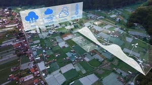
The Georgia Department of Transportation (GDOT) has selected the Aeva CityOS intelligent transportation systems (ITS) platform for deployment at 30 additional intersections across the greater Atlanta area. The expansion follows an initial rollout at sites surrounding Centennial Olympic Park and the Georgia World Congress Center, establishing what is set to become one of the most extensive LiDAR-based traffic intelligence deployments in the United States.
From Pilot Corridor to City-Wide Rollout
The initial deployment was focused on one of Atlanta’s most complex pedestrian environments: the convention and entertainment district anchored by Centennial Olympic Park and the Georgia World Congress Center. That area concentrates large volumes of pedestrians, event traffic, and multimodal transport within a compact urban footprint, making it a demanding real-world test environment for intersection-level AI perception.
The 30-intersection expansion across multiple sites in the metro area signals that GDOT has moved from proof-of-concept to broader operational commitment. No contract value has been publicly disclosed, and the timeline for full deployment has not been confirmed in the announcement.
How the CityOS Platform Works
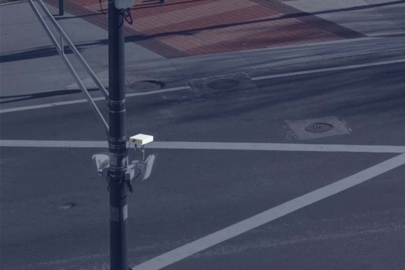
Each instrumented intersection is fitted with Aeva Atlas Orion sensors, purpose-built for fixed infrastructure use cases including traffic management and security monitoring. The underlying technology is Frequency Modulated Continuous Wave (FMCW) LiDAR, a sensing approach that differs fundamentally from conventional time-of-flight LiDAR by transmitting a continuously frequency-shifting laser beam and analyzing the returned signal to derive both 3D position and instantaneous velocity of every detected object simultaneously.
This simultaneous range-and-velocity measurement is the defining technical differentiator of FMCW-based systems. It enables precise tracking of moving road users, including vulnerable users such as pedestrians and cyclists, without requiring sequential frames to infer motion. The platform supports a range of operational functions: vulnerable road user safety monitoring, wrong-way driving detection, and real-time traffic flow analysis.
The edge AI layer processes this sensor data locally, feeding continuous situational awareness to traffic operations without reliance on centralized cloud computation for real-time decisions.
Privacy and All-Conditions Reliability as Design Constraints
A notable aspect of the CityOS architecture is its approach to privacy. Unlike camera-based ITS deployments, 4D LiDAR does not capture imagery, facial features, or license plate information, making it less susceptible to the civil liberties concerns that have accompanied expanded camera-based surveillance in urban environments. The sensor generates geometric point clouds, not identifiable imagery.
The FMCW approach also provides operational resilience across adverse conditions. The technology is meant to maintain detection accuracy in direct sun glare, complete darkness, and inclement weather, conditions where camera-based systems degrade and inductive loop detectors provide only limited spatial resolution.
GDOT and the Broader US Intelligent Transportation Context
GDOT manages one of the largest state highway networks in the southeastern United States, serving a metropolitan region that ranks among the country’s most congested. Atlanta’s transportation infrastructure faces compound pressures: sustained population growth, its function as a major logistics hub, and an events calendar that generates unpredictable surges in multimodal demand.
The adoption of a platform-based, AI-driven ITS approach reflects a broader strategic shift among US transportation agencies away from fragmented, sensor-type-specific legacy systems. The US Department of Transportation has long encouraged states to invest in intelligent transportation infrastructure, and GDOT’s choice of an FMCW LiDAR platform positions Georgia as an early mover in a technology category that remains relatively nascent at city scale.