Argentina’s Río Negro province has launched a satellite-based wildfire monitoring system covering approximately 20 million hectares of Patagonian territory, an area roughly equivalent to half the size of Spain. The deployment, announced on 25 February 2026, is a collaboration between Munich-based OroraTech, Argentine technology firm GPTech, and the provincial government of Río Negro.
The initiative centres on two newly constructed wildfire control centres in the Andean towns of Bariloche and El Bolsón, both built and operated by GPTech. These facilities use OroraTech’s Wildfire Solution platform as their digital backbone, delivering thermal intelligence and near-real-time fire alerts to local firefighters (known as brigadistas), emergency planners, and provincial decision-makers.
Two Control Centres Combine Space and Ground-Level Intelligence
The control centres are designed to fuse multiple data streams into a single operational picture. OroraTech’s proprietary satellite thermal data is combined with ground-based sensor inputs, drone surveillance footage, and communications infrastructure powered by Starlink, SpaceX’s satellite internet service. The multi-orbit connectivity approach is intended to ensure reliable data flow even in Patagonia’s remote, mountainous terrain where traditional telecommunications infrastructure is limited.
GPTech, led by founder and CEO Gabriel Porta, is responsible for the full local design, construction, equipment, and technical operation of the centres. The arrangement positions GPTech as the first locally operated satellite-based wildfire monitoring system in the region, integrating OroraTech’s space-based detection capabilities into an Argentine operational framework.
Provincial Governor Alberto Weretilneck and the Minister of Environment officially inaugurated the control centres on 14 February 2026.
OroraTech’s Growing Thermal Satellite Network
OroraTech, founded in 2018 as a Technical University of Munich spin-off, operates what it describes as the world’s largest dedicated thermal satellite network for wildfire management. The company launched eight nanosatellites aboard a Rocket Lab Electron rocket in March 2025, built in collaboration with Spire Global. These 8U CubeSats orbit at 550 km altitude and are equipped with mid-wave and long-wave infrared sensors capable of detecting hotspots as small as 4×4 metres through AI-enhanced super-resolution processing.
The company now operates ten thermal-sensing satellites in total and has raised approximately €37 million in Series B funding, with backing from BNP Paribas Solar Impulse Venture Fund, Rabo Ventures, and Bayern Kapital. OroraTech maintains operations across the United States, Greece, Australia, Brazil, and Canada, with a team of over 180 employees.
Patagonia Faces Escalating Wildfire Threats
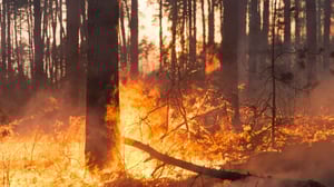
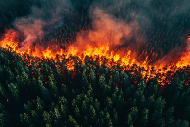
The deployment arrives at a critical time for the region. The 2025-2026 fire season has been among the most severe in recent decades across northern Patagonia. In early January 2026, wildfires in the neighbouring Chubut province alone burned over 15,000 hectares, forcing the evacuation of some 3,000 tourists and destroying homes near the Andean town of Epuyén. The Argentine government subsequently declared a state of emergency across several Patagonian provinces, including Chubut, Río Negro, Neuquén, and Santa Cruz.
The previous season was equally devastating. Early 2025 saw approximately 32,000 hectares consumed by fire in the region, with major blazes affecting Nahuel Huapi National Park near Bariloche and areas around El Bolsón, the same towns now hosting the new control centres. Scientists at Argentina’s Institute of Biodiversity and Environment have warned that the upward trend in annual burned area will likely accelerate over the coming decade, driven by rising temperatures, prolonged drought, and lightning storms that are shifting westward into denser forest zones.
Satellite-Based Wildfire Detection Gains Momentum Globally
Río Negro’s investment in space-based fire monitoring reflects a broader global trend. In October 2024, Google partnered with the Earth Fire Alliance and Muon Space to develop FireSat, a satellite constellation designed to detect wildfires as small as 5×5 metres within 20 minutes, backed by $13 million from Google.org. On a regional level, AI-powered wildfire camera networks have expanded across the western United States with the ALERTWest system, while Cyprus has deployed AI fire detection stations covering a 15-kilometre detection radius per unit.
For OroraTech specifically, the Río Negro contract represents a notable expansion into Latin American government markets. The company reported signing close to €100 million in combined commercial contracts and venture capital during 2025, and it aims to grow its constellation to 100 satellites by the end of 2027.
What the Contract Signals for Regional Emergency Modernisation
The Río Negro government has framed the satellite monitoring system as part of a wider strategy to modernise environmental protection and emergency response capabilities in the province. While no financial details of the contract have been disclosed publicly, the scope of coverage, spanning 20 million hectares, and the construction of purpose-built control centres suggest a multi-year commitment with significant provincial investment.
Whether the system proves effective during active fire events will be a key test, particularly given the region’s challenging topography and the increasing intensity of fire seasons. If successful, it could serve as a model for other Argentine provinces and South American governments grappling with similar wildfire pressures.