 in Barcelona
 3 to 5 Nov 2026
This is the New York State Thruway, a 570 -mile superhighway spanning across the state. It also includes over 800 bridges, each requiring an inspection every two years. Depending on where you are in New York State, we also have different geographies, which means we have rock slope walls. Those historically, people have to climb them. We can now do. those by drone states like new york are increasingly turning to drones for infrastructure inspection in fact inspection services rank as a top use case for commercial drones maintenance services that typically took hours if not days now completed in about 40 minutes so they're doing a number of things when they look at an inspection they'll look you know at the structural integrity of the facility they can also look at the road type surface conditions of the facility for our bridges that cross over water, we can measure water levels. But bridge inspections are seen as a low hanging fruit to those in the industry. And despite what you may read in the headlines. It's been a slow and painful process to miniaturize something on a quadcopter sized drone to be able to detect something else and avoid it. That's, you know, that's where technology still has to come. along. Tony Basile is the Vice President of Operations at Newair, the non-profit operating the drone inspections along the New York Thruway. Newair is also in charge of operating one of seven drone test sites in the United States. These test sites have a huge influence on the advancement of drone technology and regulations. The New York tests take place upstate along a 50-mile corridor. Former Governor Andrew Cuomo unveiled the corridor in 2016 with a $30 million It's here where researchers can freely test drone operations beyond visual line -of -sight, the deciding factor that many say will directly influence this industry's fate. Once you always have a pilot on the ground operating with one drone in the air, steering line-of-sight, this will never be an effective market. Current rules require commercial drone operators to fly their aircraft within visual line-of-sight. Rules also limit pilots to operations. one drone at a time. What makes this more complicated than say autonomous cars is the need to sense from all angles, above, below, and side to side. And the devices enabling the drone to see in that way must be very small to fit in a drone. A number of companies are now innovating to bring this technology to market. Qualcomm, for example, has developed an out of the box kit to simplify the deployment. We pre-integrate the sensors, we pre-integrate the cameras, and so all the . grunt work or the nuts and bolts is given to you and the German company Droneek has developed a hook -on device to more easily detect drones and other aircrafts it connects with the device's sim card to communicate that information using an LTE network on its traffic management system traditionally small drones have been difficult to detect because of their very low radar signatures it's called hook-on device because you simply hook it on the drone glue it or tape it and it has a barometric altitude sensor, it has its own GPS module, it collects FLAM and ADS -B data and it gives FLAM data back into the orbit and with this hook -on device we are connected to a so -called UTM system and with these hook -on devices we are also able to make drones visible on the radar of the UTM system. It underscores the demands for reliable connectivity. General Aviation always has the right of way, so how do we get out of the way? And how do we do that with minimal latency between the flight control input and the aircraft actually doing that? New Air has successfully operated beyond line of sight using LTE connectivity. So far, the FAA has allowed New Air to test its drones beyond visual line of sight for about 35 miles along the 50 mile corridor. Could the introduction of . . . 5G changed that. NewAir is currently testing Verizon Wireless and three Nokia radios to learn how 5G can further enhance reliability and reduce latency. They're thinking that the big game changer will actually be downloading of the data that the drone is capturing, not necessarily, although it could be a benefit as well, the command and control of the aircraft itself and what the sensor's looking at. But, but the pipe, the band. Even with a downstreaming data from the aircraft as it's flying to wherever it's got to go, that's been the big thing that, you know, especially like emergency responders, when they're at a scene, a big scene, you know, earthquake or whatever, and they're trying to download video that they're capturing to a command center somewhere, you know, that's one of the things that's lacking with this technology right now. In New York's bridge inspections, for example, the data is manually exported from an SD card after the flight. Nonetheless, the New York Thruway has seen the value of its current field tests. Listen to this. You know, some of these structures you have to get up underneath and really take a close look at the joints, where the bridge piers are, you know, connected. And so the resolution piece has been pretty outstanding. Battery life is another issue, powering the device for just 30 to 40 minutes. It takes off. a helicopter with maybe four electric motors and then they'll switch to a gas pusher prop and it looks more like an airplane flying straight along and the preferred payloads are a camera and an infrared sensor on the same payload so you can take a video and then you can also take an infrared shot and see you know what that you know what that might give you multi-spectral sensors lidar sensors there's there's gas sniffers for doing gas line power you know looking for leaks in a gas line there's all kinds of different sensors that you can put under these and that's really what the mission's about the aircraft basically is the horse that carries you know the payload um being able to fly over people you know adds another layer of complexity so in the event that your quadcopter loses a motor how do you keep that thing from falling on somebody's head and really hurting them. So there's parachutes that are starting to become, you know, kind of commonplace now. We've done, I think, five different parachute tests for different manufacturers of parachutes. There's, the FAA is also interested in maybe frangibility. So the aircraft, as it senses, it's tumbling, pieces start coming off of it so that, you know, the 15 -pound thing now weighs five pounds by the time it gets to the ground. Now, the pilot didn't cost a New York Thruway Authority any money at this time. Instead, Empire State Development Grants are funding it with about $35 million. In future phases, the New York Thruway Authority will purchase equipment as it looks to map and survey the entire 570 -mile highway. And it looks to take advantage of new business opportunities like drone deliveries. We want the Thruway Authority to be front and center in that when we look at technology like drones, we look at autonomous vehicles. You know, we have a fiber optic system here that also can play a big role in the commercialization of of the this right of way, this 570 mile right of way. So that's yet to be determined, but I'm certain that this is where all of this will lead. We really get a weird science phone call at least once a month on something that nobody thought of. They want to use a drone to do something. So once regulation accepts that and. You know, you can buy an aircraft fairly reasonably priced that can do beyond visual on a sight legally. I think you're going to, you know, these things will be doing all kinds of different missions. For more coverage on how that journey unfolds, be sure to stick with us here at Current Insights.
Why Smart City Drone Innovation Isn’t Quickly Taking Off
5GConnectivityMobilityNew YorkTraffic management & monitoring
In this video
-
 Matthew Driscoll
Executive Director, NY Thruway Authority
-
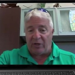 Tony Basile
VP of Operations, Nuair
-
 Ralph Schepp
COO, Droniq
- Dev Singh GM, Robotics, Qualcomm
About this video
This video delves into the evolving role of drones in industries and the challenges faced in maximizing their capabilities. We explore real world applicaitons with Matthew Driscoll from the New York State Thruway Authority while Tony Basile from Nuair, a New York-based nonprofit enabling scalable, economically viable commercial drone operations and advanced air mobility capabilities, addresses a primary obstacle: the need for miniaturization of technology to enhance drone autonomy. Current limitations confine drones to line-of-sight operations, where a ground pilot must maintain visual contact. Despite this constraint, drones have found practical applications, such as bridge inspection in New York, showcasing their potential even with existing limitations.
The discussion extends to the broader implications and future possibilities of drone technology. Experts highlight that the true breadth of drone applications remains largely untapped, particularly in areas beyond line-of-sight operations. The feasibility of the drone market in these expanded roles is a focal point of debate.
To provide further insights, the video features Dev Singh from Qualcomm and Ralph Schepp from Droniq. These companies are at the forefront of addressing the challenges faced by the drone industry. They introduce innovative solutions incorporating the latest in 5G connectivity and AI applications. These technologies are pivotal in enabling real-time tracking and operation of drones, potentially overcoming current limitations.
Viewers interested in the intersection of emerging technologies and practical applications will find this video informative. It offers a balanced view of the current state and future potential of drone technology. Industry professionals, technology enthusiasts, and those curious about the practical applications of drones in urban and industrial settings will gain valuable insights from the discussions and expert opinions presented. The video serves as a resource for understanding the evolving landscape of drone technology and its real-world implications.
Read the transcript machine-generated
More in Mobility
See all 4:11
From Cameras to Insights: VisionAI Transforms Motorway Operations
 6:29
VisionAI Helps Boost Security During 2024 Olympic Games
 8:19
Curbing Noise Pollution with AI-Enabled Solution
 7:29
Brussels’ Smart City Strategy – Part 2
 7:59
Smart Parking Landscape Changes with New Players, Enforcement
 8:13
Mobility Data: New Paradigm for Smart Cities
Latest news in mobility
All news- Abertis Opens €40,000 Safe Road Operations Challenge To Protect Road Workers10 Nov 2026
- Modaxo Acquires Brazilian Traffic And Tolling Supplier Fiscaltech8 Nov 2026
- Landkreis Hof Opens TauSENSE App To Public Using Data From 130 Road Dew-Point Sensors8 Nov 2026
- Valdepeñas Approves €225,523 Credit For €1.5M Red.es-Funded Smart Territory Project8 Nov 2026
Kurrant advisory
Planning a mobility project? Talk to Kurrant.
Behind these interviews is Kurrant's advisory team, working with utilities, cities and the companies that serve them.
- Strategy AdvisoryKurrant is actively involved in resolving the challenges that cities, utilities and industry players are facing.
- M&A AdvisorySmart city and utility expertise for successful deals, turning insights into strategic gains.
- Engineering & ProcurementBetter engineering and procurement decisions, by identifying and developing digital and IoT solutions across use cases.
Or write to us: contact@kurrant.com
Send us a message