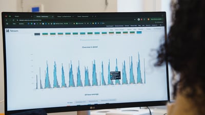
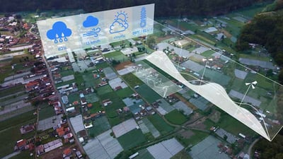
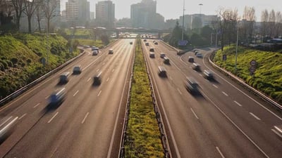
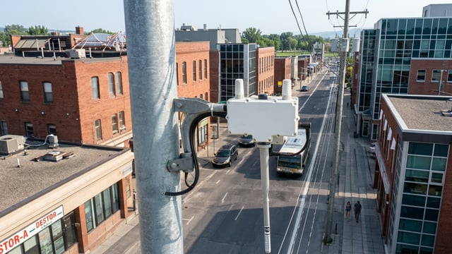
Mobility data is key in helping cities understand how people move around their territory, allowing them to make adjustments to their public transportation or even the city infrastructure. Years ago, when an authority wanted to understand mobility flows within an area, they would rely on pneumatic tubes or place people in certain sites to count traffic manually. However, with the emergence of IoT, data can now be collected through sensors or vision AI cameras, which can count in a reliable manner the amount of vehicles, cyclists and pedestrians that are using the city infrastructure. But sensors deployed in cities and roads are not the only source of data. We have map information, traffic information because we get many GPS signals pushed back to us every 30s, just about 60 million GPS points every 30s. We estimate that about seven out of ten apps, has location technology in it. So people are being tracked all the time. The cars that people drive are connected nowadays, so they also push back all the data. My phone is giving my GPS information right now. So I think there's been a real change in the last couple of years from, sort of data about infrastructure to data about the things that are on infrastructure. So people moving around, most importantly, and how they move around, whether that's floating cars, floating bikes, mopeds, shared mobility, delivery trucks. We're shifting from just this perspective of how a specific piece of road is being used to who is using it, and in what way they're using it. And I think that's quite interesting because it starts to get at the goal, which is ultimately moving people and vehicles, not just maintaining infrastructure. Mobility data is being collected every second from our smartphones through apps like Waze or even games like Pokemon Go. Something as simple as a Fitbit on your wrist can generate mobility data. But even new cars are connected and send that GPS location constantly. And we're going to be seeing more and more cars sharing data. By 2035, it is expected that over 90% of cars in the EU will be connected. And we've seen Germany's government pushing for these advancements with their Strategy for Automated and Connected Driving from 2015. This means that in cases in which this non-IoT data is available and accessible, there won't be a need to deploy sensors or cameras, which can be complex, costly and hard to scale. So the cost of acquiring the data can go down drastically and smart city project business cases can be improved. The biggest mobility data providers in the world include Google, Apple, Uber, Here Technologies, Tomtom and Inrix, who through many sources can collect, analyze and distribute the data. The mobility data has thousands of applications. So this traffic counting data can be used by cities, if they want to see the trends, what's happening in their cities. So how many vehicles are passing in their cities? How many pedestrians are passing in their cities? How many bicycles are passing in their cities? So this kind of data can help cities in their strategic planning. For instance, if they want to build a new infrastructure. We have many companies selling their own data. And there's just one company that uses open source data. And open source data is one of the trends I see. The use of open source data and being part of a community, is becoming more and more important because companies don't want to be tied in with one supplier. They want to use this open source. This type of data is mostly sought after by municipalities to understand movements in their territory. Companies like Tomtom work directly with cities, but in many cases, data brokers like MyTraffic in France or Streetlight Data in the US will acquire the data and structure it to turn it into actionable data for various city use cases, but also for private companies like retailers or restaurants. We have seen data brokers raising a lot of funds in recent years showing that that mobility data and their business models are highly valued by investors. Why? Because the data is showing incredible potential to improve mobility and businesses, but also other verticals of cities. We've seen this happen with air quality in the UK, some cities were forced to create Clean Air Zones to keep pollution in check. To make sure the redirection of traffic was working, Sheffield deployed a vision AI mobility solution along with air quality sensors to understand traffic and how it's polluting. We've also seen mobility data used for street lighting for example. Serveo and Vodafone Spain use telco data, mobility data, to understand the street lighting needs to improve efficiency and lower costs. I'm working on an air quality, solution, for a city. We cannot do that alone. But for example, there's a company that puts out air quality measurement systems in the city. And what they want to do is they want to combine that information with traffic information to see if the system can adapt to traffic streams, so they can adjust the traffic lights and maybe even reroute traffic to another direction. To make the city more sustainable to live in. The Granada region in Spain, we are using data from many, many sources, including mobility data from train organizations, train operators, airplane operators and many other institutions related to tourism and the mobility of tourists so that we can analyze and describe who is the tourist of Granada, which experience they enjoy the most, how long they are staying, and what type of satisfaction they have. To improve in terms of quantity. So bring more people there, but also in quality and also and foremost, improve the quality of the experience. When it comes to the Tomtom or the Ubiwhere use cases, the data is being paired with other types, enriching the end solution. This use of mobility data is still in its initial stages, but it is set to become more and more important in the smart city industry as the role mobility plays in municipalities is incredibly important and can even be an indicator of quality of life. Verticals like street lighting or air quality can benefit, but even waste management, as collection routes can be improved thanks to mobility data. The whole smart city approach and initiative is getting more formalized, so what we see is that a lot of new departments or new areas of responsibility are being built across administrations. So it's not the traditional traffic management department, not the energy department or whatever, but there’s smart city or mobility management departments even being built. And the next step then is usually what those departments, what we perceive is they build platforms, so they build open data platforms, that's what they start to invest in as a first step. and they collect whatever is there. And again, mobility data is widely available. Most of those cities have traffic management systems that collect already a wide area of data. Mobility data is set to also become an opportunity for smart city vendors in multiple verticals. In many cases, projects turn out better when integrating mobility data with other types of information to get a better picture of the situation. But while deploying IoT sensors can be useful in specific cases, vendors will more and more look to integrate available third party data directly from mobility. GPS or cellular data operators, or through open data platforms and specialized data brokers. As more and more cars become connected, they'll become the perfect moving sensor. This is a change of paradigm and the positive evolution towards better integration of various smart city verticals and cost effective access to actionable data, which is key to improve project business cases.
Mobility Data: New Paradigm for Smart Cities
Mobility data is key in helping cities understand how people move around their territory, allowing them to make adjustments to their public transportation, or even the city infrastructure. We’ve seen the transition of data gathering going from traditional methods like pneumatic tubes or manual counting, to IoT sensors and vision AI, and now, we’re seeing data coming in from third parties thanks to GPS signals, cellular data and connected cars. This change in paradigm means that in many projects, hardware is becoming unnecessary. Interest in mobility data only continues to grow, why? Because of its use for traffic management, but also, other smart city verticals.
In this video, we interview Jeroen Verhoeven, from TomTom, Alex Pazuchanics, from Vianova, Behzad Bamdad Mehrabani, from Transport & Mobility Leuven, Andre Guimaraes, from Ubiwhere, and Phillip Hahn, from Yunex Traffic, to talk about how mobility data is used to manage how people move in a territory, how other smart city verticals use it and how the change in paradigm is changing the game.
View transcript auto-generated


Similar Picks


📰 Latest News


🎬 Kurrant Originals


🎥 Recent Event Coverage


Featured Case Studies
Real client work behind the news. Strategy, M&A and engineering projects we've delivered for cities and utilities.

Stay in the Loop
Get smart cities and utilities insights delivered your way. Choose your channel
Join our WhatsApp Channel