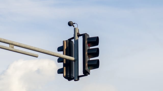
The City of Stirling has installed a non-enforcement, AI-powered near-miss camera at the intersection of Alexander Drive and Wordsworth Avenue in Yokine, in partnership with the Western Australian Road Safety Commission. The portable unit is scheduled to remain in place until September, recording near-collision data between vehicles, cyclists and pedestrians rather than issuing fines. It is one of six such cameras the Commission is deploying across the Perth metropolitan area, extending a program first piloted in regional Western Australia in 2024. The installation follows a 2025 community consultation in which residents rejected a proposed right-turn ban at the same intersection, leaving the council without an agreed fix and a data gap it is now trying to close.
A Sensor Built To Observe, Not To Cite Drivers
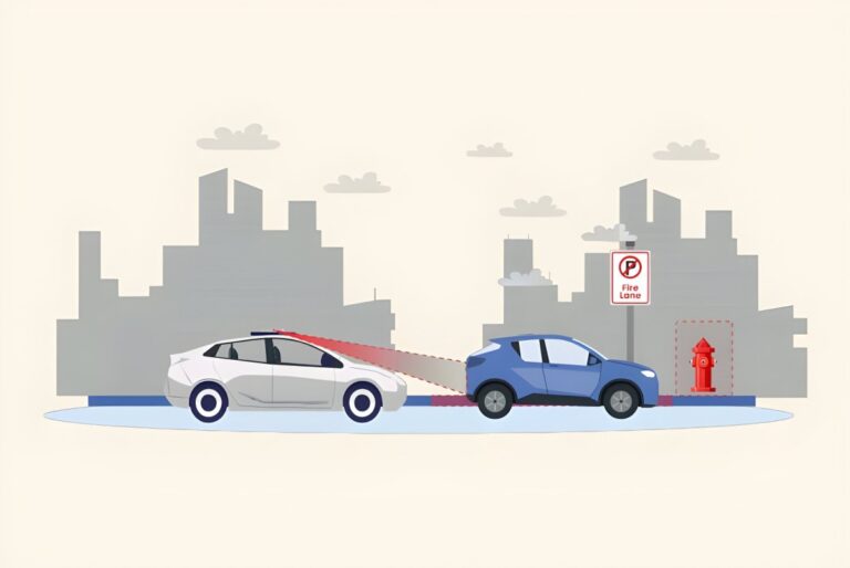
The device differs from WA’s existing fixed and trailer-mounted safety cameras, which target speeding, mobile phone use and seatbelt offences for enforcement. The Road Safety Commission’s near-miss units instead run AI software that analyses video in real time and assigns severity levels and risk ratings to each close call, with no link to infringements.
Three metrics drive the analysis: classification of road users into vehicle types such as cars, motorcycles, cyclists and buses, vehicle speed at fixed points in the intersection, and post-encroachment time, the gap between one road user leaving a conflict point and another entering it. All footage is de-identified before reaching a cloud dashboard, with faces, number plates and vehicle outlines automatically blurred.
A Crash History That Outlived A Rejected Fix
City of Stirling records show the Wordsworth Avenue and Alexander Drive intersection has a documented, if declining, crash history, with up to 21 recorded crashes in earlier years falling to 12 between 2019 and 2023. A 2025 proposal to restrict right turns from Wordsworth Avenue onto Alexander Drive drew 357 submissions, 86 per cent of them opposed, and councillors voted in August 2025 not to proceed. The camera was subsequently installed with the backing of Frank Paolino, the state member for Mount Lawley, whose electorate covers the intersection, after constituents kept raising safety concerns.
The Vendor And Platform Behind The Towers
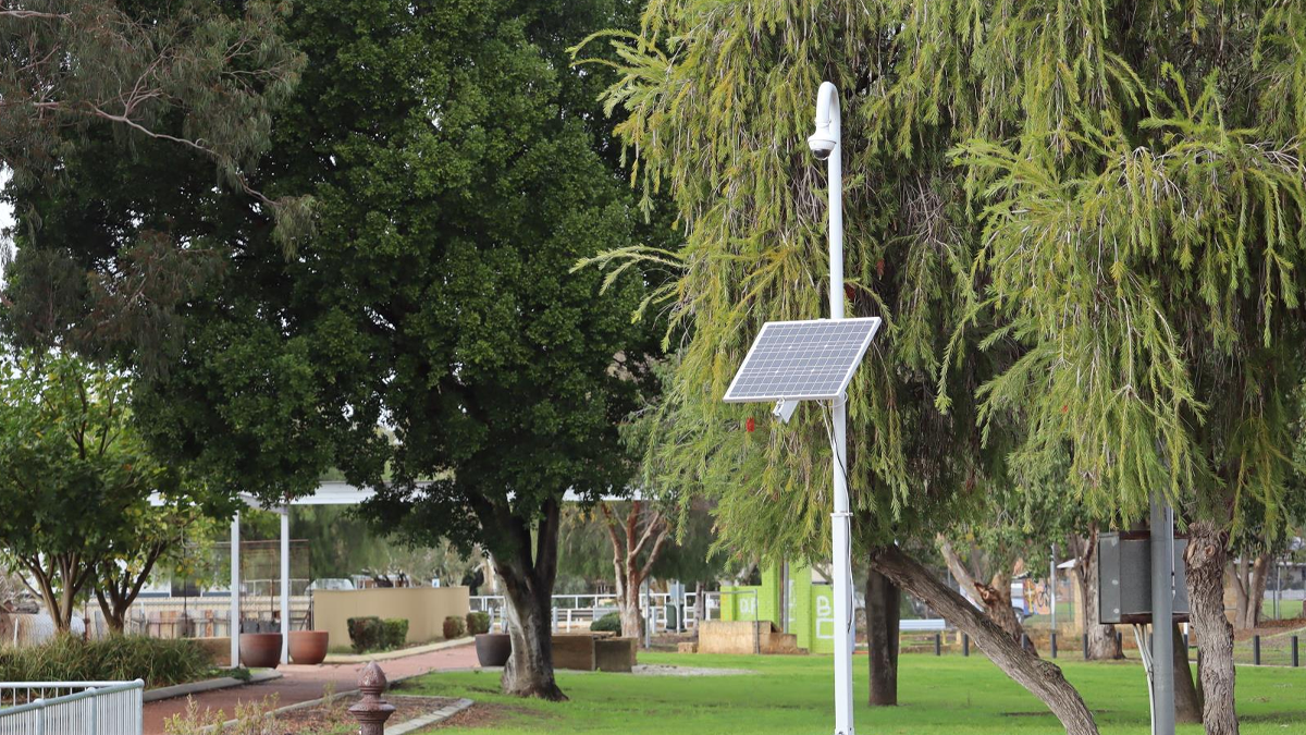
The camera hardware and analytics platform are supplied by LAB3, a Melbourne-headquartered cloud and AI services provider founded in 2017, under a product the company markets as NearMiss. LAB3 built the platform with Australian technology partner Real Time Traffic, and the same system has separately been used in Transport for NSW’s own near-miss detection program, giving the supplier a track record across two state jurisdictions before the Stirling deployment.
From A Wheatbelt Pilot To A Six-Camera Metro Network
The Road Safety Commission first trialled the technology in 2024 with the Shire of Northam, spending roughly $90,000 from the Road Trauma Trust Account on a three-month pilot at the Fitzgerald and Gairdner streets intersection before extending the trial to a second site to study pedestrian conflicts. The City of Vincent became the first Perth metropolitan council to take part in February 2025, followed by the Shire of Lake Grace that June. Stirling’s deployment is part of the six-camera metropolitan rollout that represents the program’s largest expansion since the Northam launch.
At that 2024 launch, the program’s value was framed in terms of filling gaps in conventional crash statistics. “Will help us to better understand the total picture of road safety,” said Adrian Warner, Road Safety Commissioner at the Western Australian Road Safety Commission, in the Commission’s July 2024 announcement of the Northam pilot.
Part Of A Broader Shift Toward Proactive Crash Data
Stirling’s trial sits inside a wider move by Australian road authorities away from relying solely on historical crash records toward observing near-misses before they escalate into collisions. Transport for NSW has run comparable AI trials since 2022 in partnership with the University of New South Wales and the Monash University Accident Research Centre, including a four-week pilot at two intersections that recorded 217 near-miss incidents. That rationale, using close calls as a leading indicator rather than waiting for injury data to accumulate, is the same logic underpinning WA’s expansion from a single regional intersection to a six-camera metropolitan network in under two years.
Privacy Design And What Happens After September
The Stirling camera is scheduled to operate until September 2026, after which the Commission and council will assess whether the resulting dataset supports infrastructure changes such as revised signal phasing, raised platforms or a roundabout, the same toolkit the city has weighed for other recent intersection reviews. Because the technology is explicitly non-enforcement, none of the data it collects can be used to issue fines, and the program’s stated purpose is limited to informing future road safety investment decisions rather than changing driver behaviour directly.