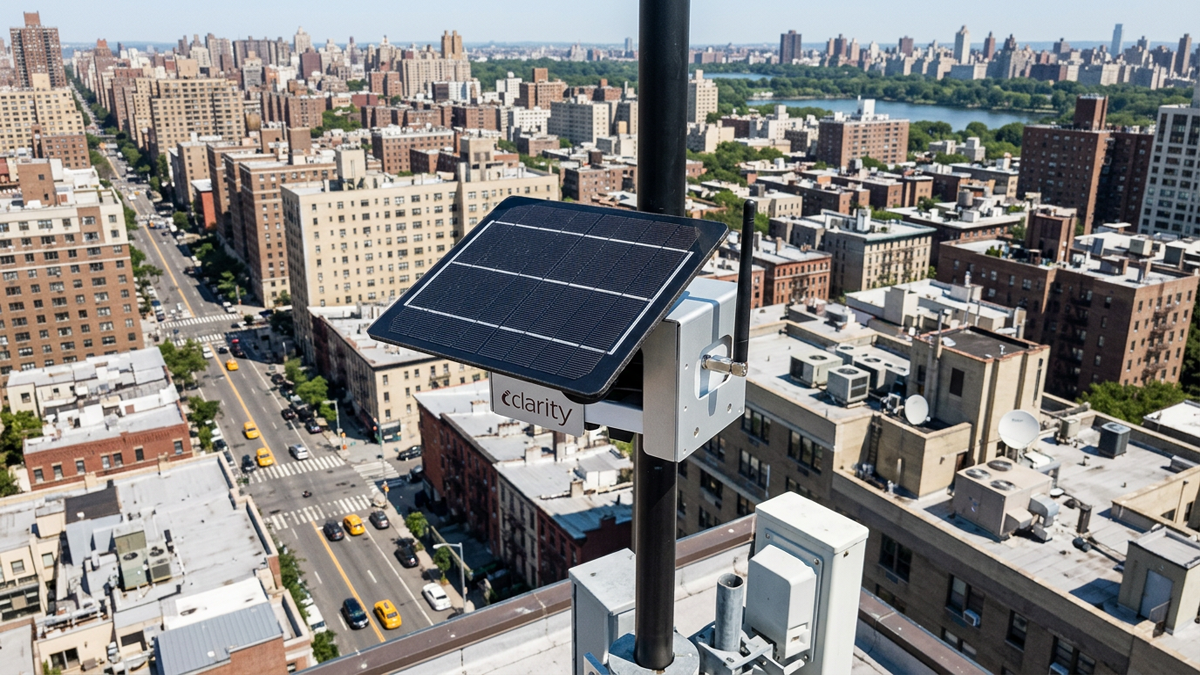
The Chicago Department of Public Health (CDPH) and the University of Illinois Chicago School of Public Health have begun publicly releasing data from Open Air Chicago, a 277-sensor hyperlocal air quality network the city describes as the largest community air monitoring system in the United States and the second largest in the world. Public access to the data opened on 4 February 2026, streaming fine particulate matter (PM2.5) and nitrogen dioxide (NO2) readings from solar-powered Clarity Node-S units fixed to light poles across roughly 60 ZIP codes. Built to supplement rather than replace federal-grade monitoring, the deployment gives utilities, agencies and smart city teams an unusually complete reference case in dense sensor grid design, hybrid funding and open data delivery.
A Network Rooted In A Civil Rights Fight Over General Iron
The effort traces back to a 2018 dispute over relocating the General Iron scrap-metal shredding operation from the largely white Lincoln Park neighborhood to the predominantly Black and Latino Southeast Side, according to reporting by the Chicago Sun-Times. A civil rights complaint followed, and a 2023 settlement between the city and community groups included commitments to citywide air monitoring. Grist reported that the resulting network cost more than $4 million to launch, positioning it as a durable public health asset rather than a short-term research pilot.
How EPA Criteria And An Equity Index Produced A Variable Grid
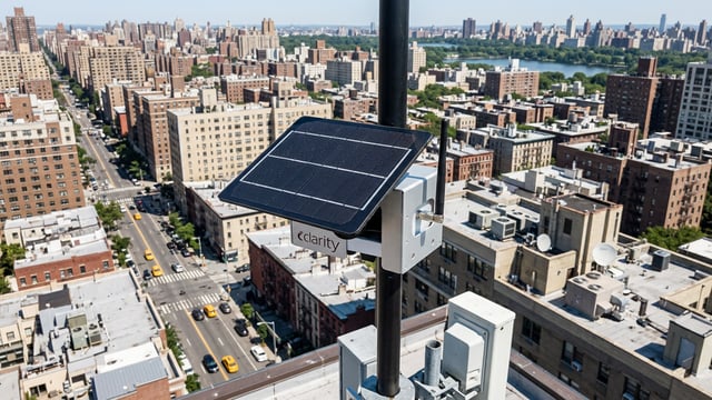
Over six weeks in summer 2025, crews from the Chicago Department of Transportation installed the sensors on city light poles, with installation finishing by September 2025. Siting followed the U.S. Environmental Protection Agency Clean Air Act network design criteria for ambient monitoring, layered against Chicago’s Environmental Justice Index published in 2023, CDOT light-pole engineering rules, and input from a 13-organization community advisory board.
The outcome is a deliberately uneven grid. Sensors sit 0.87 miles apart in areas with higher Environmental Justice Index scores and 0.93 miles apart elsewhere, keeping every location under a mile from the nearest monitor. Roughly 64 percent of units fall inside designated environmental justice areas, per slides that project lead Serap Erdal presented to a Health Effects Institute meeting in April 2026.
That density marks a sharp step up from Chicago’s existing federal reference network, which the project puts at four regulatory PM2.5 stations and two for NO2. More than 350 Node-S units were initially purchased, with 277 ultimately deployed and collocated at a city facility for about four weeks beforehand as part of quality control preparation.
What Sits On The Poles: Clarity Node-S Specifications And Their Limits
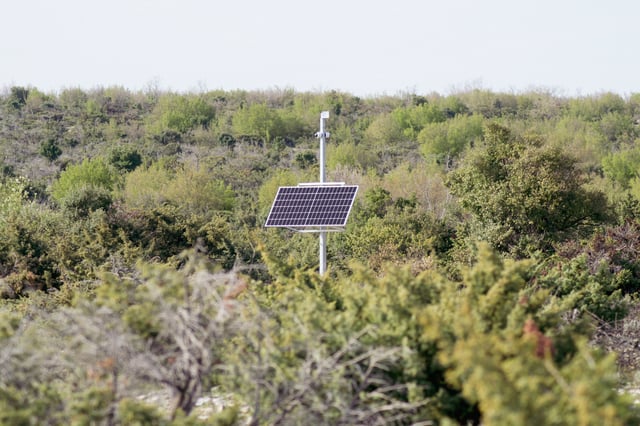
The Node-S is a self-powered, cellular-connected monitor built around optical particle sensing, drawing air across a laser-scattering chamber to count particulates while a separate module tracks NO2. It runs on solar power with battery backup, which Clarity says can sustain operation for up to 30 days without sunlight, and the company specifies a minimum two-year field life. Housings carry FCC and CE marks along with an MCERTS certification for solar-powered use.
Crucially for procurement teams, the unit is not a federal reference or federal equivalent method instrument. Clarity’s own product literature states plainly that the Node-S is not a regulatory-grade monitor, and CDPH is explicit that the data cannot support permitting, compliance assessment against national standards, or enforcement. Beyond the core PM2.5 and NO2 layer, six black carbon modules owned by UIC extend pollutant coverage on a subset of sites, though the dataset notes those modules were offline at launch.
A Three-Part Funding Stack Spanning Federal, Utility And Municipal Money
The anchor funding is a $2 million grant that Erdal secured in 2023 from the National Institute of Standards and Technology, part of the U.S. Department of Commerce, through a congressional earmark. The award, grant number 60NANB23D206, runs from October 2023 to September 2026. A second, separate grant came from regional electricity utility ComEd, administered alongside partner RHP Risk Management, and ran from January 2025 to January 2026.
Ownership is split accordingly: about 60 percent of the sensors were bought with UIC research grants and CDPH purchased the rest, reflecting where each stream of money originated. CDPH’s February 2026 launch announcement credited the City of Chicago, U.S. Senator Tammy Duckworth, NIST and ComEd as the supporting parties.
“The community must be able to trust the data,” said Serap Erdal, Open Air Chicago project lead and professor of environmental and occupational health sciences at the University of Illinois Chicago, in a UIC School of Public Health feature published in May 2026.
Two Public Doors Into One Dataset
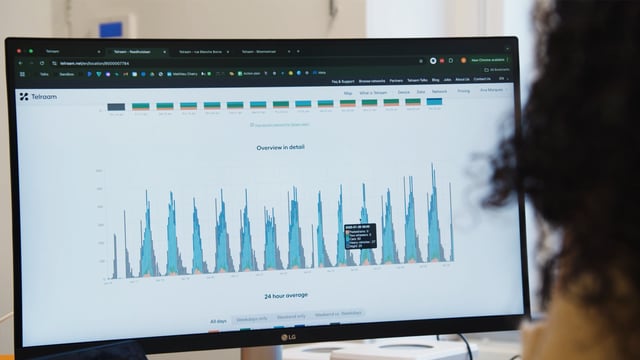
Measurements reach the public through two channels serving different users. The Clarity Open Map lets residents find their nearest sensor, check current readings and 24-hour trends, view health guidance, download 30 days of data per sensor, and sign up for unhealthy-air alerts.
The Chicago Open Data Portal hosts the underlying dataset, offering raw and cloud-calibrated readings plus hourly and daily aggregations for independent analysis. Each row records a single reading from a single Node-S, with a global correction factor applied to the calibrated values, a structure that suits researchers and agencies wanting to run their own quality checks.
Chicago Joins A Widening Cluster Of Light-Pole Sensor Cities
The model is already replicating across the country. Clarity has run comparable networks with Philadelphia’s Breathe Philly, which ordered 76 Node-S units after a pilot, and Washington DC’s Department of Energy and Environment, according to a Clarity webinar recap of the three cities. Philadelphia reported very high correlation with reference monitors during collocation testing, in the range of 97 to 99 percent per that recap.
The wider market context is one of expanding public investment in low-cost monitoring, a trend Kurrant previously covered when the EPA allocated $83 million to enhance air quality monitoring after tightening its soot standard. On unit economics, Fierce Sensors reported individual Node-S sensors ranging from roughly $200 to $1,300 depending on volume and configuration, with a sensors-as-a-service option available. Chicago’s grid remains smaller than London’s Breathe London network, which operates more than 400 sensors, but none of these deployments is used for regulatory enforcement.
Why The Governance Template Outweighs The Readings
For network operators and instrumentation suppliers, the significance of Open Air Chicago lies less in its pollutant figures than in what it documents. It shows equity-weighted grid spacing as a repeatable, citable method, and it demonstrates that a city, a university and a utility can co-fund infrastructure provided asset ownership and maintenance are defined early.
The funding durability is itself a benchmark, spanning a multi-year federal grant, a utility grant and municipal in-kind support rather than a single source, though hosting and maintenance costs still need planning beyond installation. Scheduled to keep collecting data for around five years, into 2029 to 2030, the network gives procurement teams weighing their own hyperlocal expansions a full design, funding and governance model to reference at a scale few community networks have reached.