Bexar County officially launched its $21 million NextGen Flood Warning System on May 19, 2026, replacing a decade-old beacon-based infrastructure with a network of sensors, automated road gates, and predictive modeling software designed to compress warning times from up to 45 minutes down to approximately five. The rollout, carried out in partnership with the San Antonio River Authority (SARA) and the City of San Antonio, was announced on a day declared Flood Awareness Day in the county.
A Tragedy That Forced Action
The investment traces directly to a June 2025 flash flood at Beitel Creek in San Antonio that swept vehicles off roads, prompted 70 water rescues, and claimed 13 lives. The event, which sent five to seven inches of rain into Salado and Beitel Creeks in a matter of hours, exposed critical gaps in the county’s ability to relay timely warnings to motorists and emergency responders.
“Last June, when five to seven inches of rain fell, you heard the battle in Salado Creeks, roads disappeared, vehicles were swept away, 70 water rescues were conducted, and 13 people in our community lost their lives. We honor them today not only with remembrance, but with action that can help save lives in the future,” said Bexar County Judge Peter Sakai, in remarks delivered at the May 19 Flood Awareness Day press conference.
Rather than wait for state grant programs, which allocated $50 million across 30 Texas counties declared disaster areas, Bexar County committed its own $21 million in August 2025 and began work immediately. As Judge Sakai noted at the time, “We moved very fast.”
How the NextGen System Works
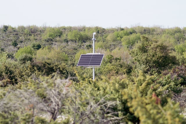
The NextGen system replaces the county’s older High-Water Alert Lifesaving Technology (HALT) setup, which relied on flashing beacons triggered only after water had already risen to a dangerous level at a crossing. The new architecture introduces upstream sensors that detect rising creek levels before water reaches the road surface, feeding data into predictive flood-modeling software that syncs with radar inputs, rain gauges, and upstream sensors.
When thresholds are crossed, the system triggers railroad-style gate arms that physically lower across roadways, accompanied by flashing warning lights, to prevent drivers from entering flooded zones. Real-time crossing data is simultaneously pushed to BexarFlood.org, where residents can monitor conditions and subscribe to text or email alerts for specific crossings near their homes or commute routes. Critically, the system also feeds live flood data into navigation platforms including Waze and Google Maps, reaching drivers before they approach a hazard.
Bexar County Manager David Smith described the upgrade’s predictive dimension: the system is designed to “couple the state-of-the-art modeling of our water sheds county wide that the River Authority has already done and turn it into a predictive model.” An expanded regional monitoring portal at sariverflood.org extends coverage to Bexar, Goliad, Karnes, and Wilson counties.
Warning Times Cut by Factor of Nine
The performance improvement is measurable. Derek Boese, general manager and CEO of SARA, stated that the existing system required 30 to 45 minutes to collect sensor data and relay it to emergency partners. Under the NextGen system, that window will narrow to approximately five minutes. SARA will assume full operational and maintenance responsibility for the gauges once the rollout is complete.
Officials confirmed that 91% of the gauges in Bexar County have already been upgraded, with a county-wide target of 95% by 2027. The full project is expected to reach completion by summer 2027, two years after the Beitel Creek disaster. New gauge locations are being selected based on rainfall mapping and historical data showing where water rises most rapidly.
There are more than 200 marked low-water crossings in Bexar County, with an additional number of crossings that currently lack any signage. The NextGen system will improve coverage across both categories through new sensor installations planned for this coming summer.
Public Awareness and Cross-County Coordination
Alongside the technical launch, officials unveiled a public safety campaign called “Floods Don’t Care,” developed in partnership with surrounding municipalities. The campaign is aimed at reinforcing a single behavioral message: motorists should never attempt to drive through flooded roadways, regardless of vehicle type or perceived water depth.
Jim Campbell, Vice Chairman of the Board at SARA, articulated the cross-jurisdictional dimension of the effort, noting that floods do not respect geographic boundaries and that collaboration with upstream counties such as Kendall, Medina, Comal, and Bandera is essential. SARA has indicated it will also work toward a shared data model that could eventually allow flood data from one area to inform predictive alerts for downstream communities before rainfall events even begin.
The NextGen system is part of a broader pattern of municipal investment in real-time urban flood monitoring. Kurrant has previously reported on Chicago’s deployment of Hyfi’s Verizon-backed 5G flood sensor network, which uses acoustic pulse sensors to generate live flood maps for city managers and emergency services. San Antonio’s parallel push into infrastructure digitalization has also extended to water metering, with Kurrant documenting how the San Antonio Water System completed the nation’s largest AMI smart meter overhaul ahead of schedule.
The convergence of predictive modeling, automated physical barriers, and citizen-facing digital tools in Bexar County’s approach reflects a growing consensus among U.S. counties that legacy flood alert systems, built around reactive sensor thresholds, are inadequate for the pace of modern flash flood events.