The City of Buffalo has formalized a partnership with infrastructure intelligence company CYVL to introduce AI-powered LiDAR scanning across its street and sidewalk network, replacing what city officials describe as decades of reactive and politically influenced paving decisions with an objective, condition-based model. The contract, announced in April 2026 by Mayor Sean M. Ryan alongside the release of the city’s 2026 paving list, marks a structural shift in how Buffalo will identify, rank, and schedule road maintenance from 2027 onward.
Why Buffalo’s Street Backlog Required a New Approach
Buffalo’s road network has long carried one of the heavier deferred maintenance burdens among mid-sized American cities. The Buffalo Department of Public Works currently rates streets on a scale of 1 to 10, with assessments conducted by city engineers, a methodology that has drawn criticism for lacking the granularity and consistency needed to defend capital planning decisions to residents and elected officials. The 2026 paving programme will direct more than $14 million toward resurfacing priority corridors including portions of Main, Hertel, Elmwood, Grant, and Linwood, streets selected under the existing engineering review process. Data collected by CYVL, however, will not feed the 2026 list but will be the primary input for the 2027 list and beyond, giving the city a full construction cycle to build and validate the new scoring methodology before acting on it.
How CYVL’s Infrastructure Intelligence Platform Works
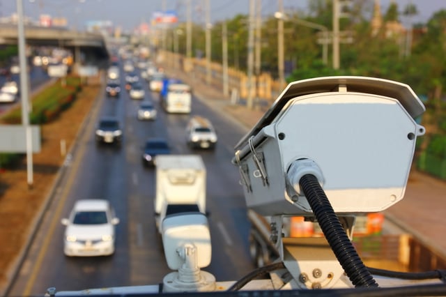
CYVL operates a proprietary mobile sensing platform that mounts on standard vehicles and captures pavement and right-of-way data at posted road speeds. The system fuses sub-inch LiDAR with 360-degree street-level imagery and RTK GPS positioning, generating lane-level point clouds and pavement distress classifications across an entire municipal network in a matter of days rather than weeks. Its AI models cross-reference the imagery and LiDAR measurements to score distress by type, extent, and severity, and simultaneously inventory assets including ADA ramps, catch basins, curb cuts, signs, and signals. The platform integrates with standard asset management and GIS environments such as ESRI and CityWorks, allowing public works departments to move from raw scan data to defensible capital plans without intermediate manual processing.
For Buffalo, the technology will underpin a formal “needs-based paving model” in which future street selections are driven by condition scores rather than complaint volume or discretionary judgement. The dataset will also serve a parallel mandate: updating the city’s Americans with Disabilities Act transition plan, which has not been comprehensively revised in 12 years. Accessible infrastructure improvements tied to the ADA compliance component are partly funded through the federal Safe Streets programme, which contributed to an overall contract cost of approximately $400,000.
Transparency Tools and Resident-Facing Accountability Mechanisms
Beyond the technical assessment layer, the announcement introduced a set of public-facing accountability tools that the city says are designed to keep residents informed throughout the paving cycle. A GIS-based mapping interface on buffalony.gov/paving will allow residents to view the paving list, understand how individual streets are scored and ranked, and track a repair timeline. The BUFFALERT notification system will provide advance alerts before work begins in a given block, and physical paving cards will be distributed in affected neighbourhoods.
The combination of a public scoring methodology, an interactive map, and proactive resident notification represents a meaningful step beyond the standard practice in most American cities of publishing static paving lists with limited explanatory context.
CYVL’s Municipal Network and Comparative Deployments
CYVL’s client roster now includes more than 500 cities across the United States, with Buffalo joining a cohort that includes Boston, Atlanta, Nashville, and Green Bay.
The approach is part of a broader trend in municipal infrastructure management in which AI-assisted sensing platforms are replacing manual windshield surveys and periodic consultant-led assessments. Traditional pavement condition surveys, conducted on foot or by slow-moving inspection vehicles, can take months for a mid-sized city and produce data that is outdated by the time it informs a paving budget. Mobile LiDAR combined with AI classification compresses that cycle dramatically and enables annual or even quarterly network refreshes.
Federal and State Infrastructure Backdrop
Buffalo’s move toward data-driven pavement management coincides with a period of elevated infrastructure investment at the state level. New York Governor Kathy Hochul announced in early April 2026 a record state effort to address road conditions across New York following an unusually harsh winter, with the New York State Department of Transportation committing more than $600 million to over 180 paving projects covering roughly 4,000 lane miles statewide during the 2026 construction season. In Erie County, where Buffalo is located, state-funded resurfacing of sections of I-90 is already underway. The city’s investment in condition intelligence, even at a comparatively modest contract value, positions it to make a stronger case for future capital allocations by demonstrating that spending decisions rest on objective, auditable data rather than anecdote.
Mayor Ryan’s proposed 2026-2027 City of Buffalo budget, released earlier this year, earmarks additional resources for the Department of Public Works with a specific focus on pothole response, street lighting, and fleet capacity.