France has formally launched JUNN (Jumeau Numérique National), a national digital twin programme intended to give the country a sovereign technological base for simulating, visualising and anticipating the evolution of its territories. The initiative, unveiled on 13 April 2026, is co-piloted by the IGN, the Cerema and Inria, with technical and operational coordination handled by 1Spatial France. It carries a total envelope of around €40 million over three years (2026–2029), of which €25 million is funded under France 2030 and operated by the Banque des Territoires.
A Federated Backbone Rather Than Another Local Twin
The programme’s central premise is that France already has a number of mature local territorial twins, but they operate as silos. Pilot deployments exist in Vendée, the Port of Bordeaux, Lille, Angers Loire Métropole and Rennes Métropole, the last of which has worked with Dassault Systèmes on its Virtual Rennes platform, but their data models, interfaces and simulation outputs are not interoperable. JUNN is positioned not as a replacement for these efforts but as a shared backbone that harmonises standards, mutualises software bricks and constitutes a national common pool of geographic data.
This is consistent with the broader European direction of travel on local digital twins, where projects such as the Interreg North-West Europe Twin4Resilience programme are also working to connect city-level twins. France’s bet with JUNN is that a state-led, sovereign infrastructure can accelerate convergence faster than bottom-up coordination alone. Kurrant has previously examined how French metropolises such as Angers and Dijon have approached centralised data platforms in its coverage of smart city control centres in France, which shares conceptual ground with the territorial twin approach JUNN seeks to scale nationally.
Consortium Architecture and Technical Roles
JUNN is built around a consortium of 14 public and private partners, supported more broadly by an “Équipe de France des jumeaux numériques de territoires” of more than 200 contributors, local authorities, engineering consultancies, SMEs, start-ups and research institutes, that responded to a 2024 call for commons.
Within the consortium, the IGN contributes its expertise in production and governance of geographic reference data. Inria, alongside Géodata Paris and GeometryFactory, provides the scientific and technological building blocks for 3D and temporal models, knowledge graphs, AI and advanced interactions. The Cerema structures the use cases and the interfaces with business applications, territorial actors and European standards.
Additional core capabilities come from the CNES on space data, high-performance computing and predictive models, IFPEN on the orchestration of complex systems, and the BRGM on subsoil and groundwater modelling. Industrialisation and integration are led by 1Spatial France, with Camptocamp supporting architecture, infrastructure and natural-language interactions. Production of the digital models for the pilot territories is assigned to Geofit/IGO, Siradel and LuxCarta. Cap Digital is preparing the operational phase by structuring the industrial pipeline and the economic model. Dassault Systèmes is expected to contribute upstream on the urban climate-adaptation use case using its multiphysics simulation capabilities.
Use Cases Anchored in Climate and Regulatory Pressure
The priority themes were defined from needs surfaced by territorial actors and skew strongly toward climate resilience and resource management: natural-risk prevention covering flooding, coastal retreat and seismic risk; sustainable urban planning; mobility; forest and water-resource management; renewable energy deployment; biodiversity assessment; and epidemic response.
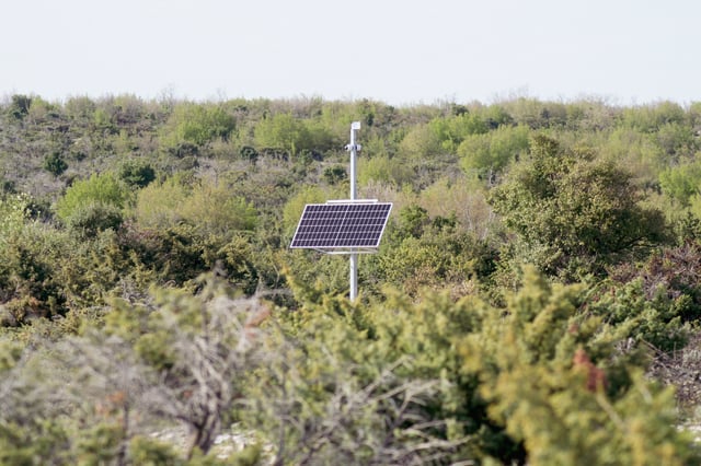
Renewable energy siting is one of the more directly regulatory-driven applications. France’s APER law on the acceleration of renewable energy production requires local authorities to identify zones suitable for renewables development. JUNN is intended to let municipalities cross-reference solar and wind potential, environmental constraints, planning rules and land availability in a single environment — a workflow currently fragmented across multiple unconnected tools.
Three Scientific Challenges and a Phased Roadmap
The programme is structured around three research axes. The first is representation: rebuilding semantically enriched 3D models capable of integrating data of very different origins and scales. The second is interoperability: ensuring that existing twins can communicate and that simulations are portable between territories. The third is visualisation and interaction: making the tools usable by elected officials, technicians, crisis managers and citizens without specialised technical training.
Deployment will be progressive. The first year focuses on the core technical stack and the initial 3D datasets. Year two adds applications that enrich usage. By year three, the system is expected to be complete, reliable and usable at scale. Operational exploitation begins in 2029 under an economic model combining public funding, private partnerships and service-cost contributions. Within 18 months, the platform should expose initial 3D data covering several departments, immersive visualisation tools and connections to high-performance simulation environments. The first pilot territories have been identified as the Alpes-Maritimes, Charente-Maritime, Gironde and Ille-et-Vilaine departments.
Market Context
JUNN sits within an expanding global market for territorial and infrastructure digital twins, where utilities and municipalities are increasingly deploying virtual replicas to manage assets and anticipate climate stress. Recent examples covered by Kurrant include Arcadis’s $5.7 million digital twin of Houston’s water distribution network, ACCIONA’s digital twin of Hong Kong’s Tseung Kwan O desalination plant, and Neara’s 3D grid twin deployed by CenterPoint Energy across the Greater Houston service area. What distinguishes JUNN is its national scope and its explicit positioning as sovereign public infrastructure rather than a vendor-led service offering — a framing that mirrors France’s broader industrial-policy posture under France 2030.