Surrey Wildlife Trust has deployed an early-warning wildfire detection system across the Elstead Group of Commons in Surrey, England, launching an 18-month field trial aimed at protecting one of the UK’s most ecologically sensitive lowland heathland landscapes. The initiative follows two wildfires that broke out at Hankley Common and Blackheath Common in the weeks prior, reinforcing the urgency of real-time fire monitoring in an area with a documented history of human-caused ignitions.
A Fragile Ecosystem Under Growing Fire Pressure
The Elstead Group of Commons, encompassing Elstead, Royal, Bagmoor and Guinea Commons, is a designated Special Area of Conservation and forms part of the Wealden Heaths National Nature Reserve. The site supports species that are rare or declining across the UK, including nightjars, Dartford warblers, lesser-spotted woodpeckers, cuckoos, stag beetles and breeding toad populations. Surrey Wildlife Trust manages the site in partnership with the Ministry of Defence, which owns the common land.
The heathland has faced repeated fire events in recent years. Blazes at Hankley Common in July 2022 and April 2021 damaged significant areas and required intervention from multiple firefighting units, including Ministry of Defence contracted aerial support. Surrey Wildlife Trust has previously estimated that wildfires have destroyed roughly 20% of the heathland it manages across large sites. Most lowland heathland areas in Surrey are assessed as being at high risk from human-caused ignitions, a threat the organisation says is escalating as the climate warms.
How the EmberEye System Works
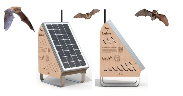
The detection technology at the centre of the trial is EmberEye, a Cambridge-based startup that has developed an ultra-early wildfire detection system targeting fire identification within one minute of ignition. The company was founded by electronics engineer Enrico Miraglia Del Giudice and remote sensing specialist Kyle Nisbet, and has been supported through the Cambridge Judge Business School‘s Accelerate programme and the European Space Agency’s BIC UK incubator, where it is also developing satellite-integrated detection capabilities to complement its ground-based network.
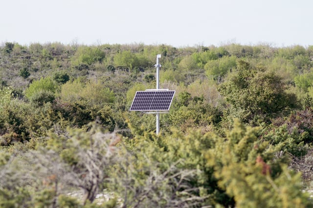
The sensors are battery-powered and positioned high in the tree canopy. They detect the infrared thermal signature of flames rather than recording visual or audio data, and activate exclusively upon confirmed fire detection. Alerts are routed through a cloud-based dashboard to land managers and emergency responders. The system does not capture images or sound and does not track individuals, a design choice that directly addresses privacy considerations on publicly accessible land.
EmberEye uses geographic information system data and satellite-derived risk models to optimise sensor placement relative to high-ignition-probability zones, incorporating terrain analysis, historical burn patterns and weather data. The company describes this methodology as building a digital twin of the land to guide deployment strategy.
A Multi-Agency Model for Habitat Monitoring
The Elstead trial brings together several organisations beyond the charity itself. Surrey Fire and Rescue Service, the Defence Infrastructure Organisation, and Surrey Hills National Landscape are all participating alongside Surrey Wildlife Trust. The structure reflects a wider operational model in which land managers, emergency services, and asset owners share access to a common monitoring layer, each with a distinct operational stake in rapid fire response.
This trial sits within a growing body of sensor-based wildfire monitoring deployments. Kurrant has documented how, following the catastrophic 2023 Maui wildfire, Hawaii deployed AI-enabled smoke-detection sensors by N5 Sensors across its fire department areas in partnership with the US Fire Administration. In the Mediterranean, the Municipality of Paralimni-Deryneia in Cyprus commissioned a 15-station AI fire detection network based on visual analysis rather than infrared thermal sensing. The Surrey deployment is distinguishable by its passive infrared approach, its conservation context, and the absence of any camera or imagery component.
UK Heathland as a Permanent Risk Landscape
Britain hosts approximately 20% of the world’s remaining lowland heathland, and Surrey is home to more than a dozen protected heathland reserves. These habitats require intensive management to resist scrub encroachment and are acutely vulnerable to fire during dry summer months, exactly the period when ground-nesting birds and reptiles are most exposed and least able to relocate.
The 18-month trial will allow the partnership to assess detection reliability, alert latency, and system resilience across multiple seasonal cycles, including the peak fire risk period. EmberEye indicates its sensors are built for a five-year operational lifespan with continuous 24-hour monitoring, parameters that are material for evaluating the case for permanent deployment at this and comparable sites across Surrey and beyond.
Surrey Wildlife Trust has also encouraged visitors to refrain from lighting fires or barbecues on the commons and to dispose of cigarettes and litter responsibly, a reminder that the sensor trial augments rather than substitutes for land user behaviour as the primary line of defence against ignition.