 in Barcelona
 3 to 5 Nov 2026
Welcome to San Francisco, ranked the fifth in the world for the worst traffic. At night, when you expect no traffic, yes, traffic everywhere. How long's it been? Two hours almost. And how far have you gone in that time? Maybe a mile and a half. San Francisco has always been a city to be an early adopter of new technology. And, quite frankly, old. existing current technology is not going to solve the problem. But could a new solution that uses LiDAR be the missing link? We completed the project, and now we gather a lot of information, and we find out, for instance, that a majority of the time, cars are actually stuck at the intersection, even though there is potentially an opportunity for them to drive through. LiDAR is a type of technology that uses laser pulses to build a 3D model of the environment. It's often used in self-driving... with many describing it as a godsend that enables the cars to see. Everybody says this is the future for when it comes to autonomous vehicles. Do you agree with that? Absolutely, absolutely. It's extremely important that vehicles in the future have that valuable depth information to be able to accurately perceive the environments that they're driving in. But not everyone agrees. Elon Musk famously said, LIDAR is a fool's errand, and anyone relying on LIDAR is doomed. continues to be a source of debate in the AV world, which also continues to be hammered by federal regulations. As a result, industry players are finding new use cases for the tech. And today we'll explore what that looks like in tackling one of San Francisco's biggest challenges. So San Francisco's smart city strategies really started to emerge in the mid-2010s. There were a lot of things going on in the city at that point. in time. You know, as I mentioned, affordable housing was a big crisis issue, as is, you know, transportation. San Francisco's tech industry, which led to a boom in the population, is often blamed for the lack of affordable housing and congestion. But the seeds to the problems have actually been spreading for years. We went through a very bad time in the 40s and 50s into the 60s where we had a redevelopment agency that was literally bull- bulldozing neighborhoods. And at the same time, there was a plan to put all sorts of freeways all over San Francisco, which would have ruined the city. There was a reaction to that, which was a good thing, but we went too far in the other direction. When a community decides it's not a priority to build housing, and housing is somehow a bad thing because we don't want development, we don't want to block views, we don't want more competition for parking, you end up over time creating a massive shortage. That shortage has created a unique situation in the city of Brotherly Love, where some workers commute over 60 miles into San Francisco. One study says Bay Area commuters spend over 100 hours a year in traffic. So they started deploying a lot of mobility strategies, everything from micro -mobility, they were experimenting with micro -transit, you know, they were developing innovations related to, you know, private access to... um to bus lines for example that too was met with controversy became known as the google bus protest that began in late 2013. using bus stops created for city buses the private coaches pick up a cargo of workers who for the most part have moved into the city and worked 30 or 40 miles south of it at places like google facebook apple ebay and yahoo these shuttles use the city's bus stop and in return the tech companies pay the city a dollar per bus per stop. But critics still blasted the shuttles for the rise in congestion. Joe Google moves into the apartment from which Jose Auto Mechanic has been evicted. Jose Auto Mechanic is now going to move to Vallejo and have a hellacious commute to the auto body shop. San Francisco now estimates that around 30 people die each year in a city. as a result of a traffic-related incident, among the worst in the nation. Speed cameras are illegal in the state, but other technologies have been implemented with the help of $11 million in funding from the U.S. Department of Transportation. Those developments include smart traffic signals, a connected electronic toll system for congestion pricing, the deployment and testing of electronic and autonomous shuttle buses, among other initiatives. But the problem was, the technology deployed at this time consisted of siloed... solutions, making real -time dynamic traffic management impossible. That is until San Francisco deployed a new solution using LiDAR. Quatergy and Cisco deployed their solutions starting in 2019 at five intersections as a proof of concept. It uses a LiDAR sensor and a perception software that's integrated with Cisco's network infrastructure. lot of technologies uses basic light pulses that are generated at a very high frequency and then when they illuminate an object it could be a person could be a vehicle or could be a wall would be reflect back and then a sensor would basically count how many reflections come back and therefore determine also the distance of the object that's it there's no pictures there's no facial recognition there is no video so uh from a PII standpoint is very, very safe. The city implemented the solution at five intersections where it was able to collect and analyze data to learn things like this. How much time are people actually spending a traffic light? What direction are most drivers heading? How many times could there have been accidents? And with those insights, the city can now time its traffic light more intelligently than is done today. The classical way is one intersection will tell the next intersection, hey, there are so many cars coming and you need to try to adjust. But with the data of Qanergy, we can say there's four people waiting, right? There's two cars coming. The traffic controller right now typically doesn't know cars are coming and that one person pressed the button. Yeah, but with our rule engine, we can say, okay, pedestrians take priority over those two cars. San Francisco is one of Qanergy's 25 smart city projects, and the company isn't only using Lidar to manage traffic. In cities like Miami, it's using the solution to measure social distancing at the airport. The same technology used in a smart city can also help determine the distance between people. So if you and I were at an airport, for instance, the LiDAR sensor can detect the distance between us. And so it can tell us if you are at six feet apart, if you are at four feet apart. So we can use that to raise alerts for statistical purposes, to control capacity in an environment. Let's say you have a maximum capacity of, say, 10 people, 20 people. And so it becomes a very important technology to help us keep us safe at the same time to enable a safe return to business or to activity that we would like to do. It showcases a unique use case of LiDAR, which critics have previously said was too expensive to make commercially available. It's like having a whole bunch of expensive appendices. One appendix is... Well, now they want to put a whole bunch of them. That's ridiculous. Linear, it's actually become much more cost-effective now, and the technology has evolved over the last few years. But what's more important is the cost when we deploy across an entire area, right? So, for instance, let's think about an airport. When you want to cover an area like an airport, which is pretty broad, you need to cover sometimes thousands and thousands. of square meters with high with high precision sensors so cameras today have a very narrow field of view so they cover a very narrow area about maximum 100 square meters with our sensor we can call we can cover between 5 000 to 15 000 square meter with a single sensor so the number of sensor required is much lower and therefore the actual cost pair coverage area is between 10 times to 20 times lower compared to camera. San Francisco is now on its second proof of concept using the tech in a push to gain a technical blueprint on how to scale a technology citywide. At that point, it will be up to the city on whether it wants to fully fund the initiative. For more coverage on San Francisco's smart city initiatives and LiDAR, stay with Current Insights.
Is LiDAR key To San Francisco’s Smart City Transit Puzzle?
MobilitySan FranciscoTraffic management & monitoring
In this video
-
 Enzo Signore
CMO, Quanergy
-
 Ben Boehme
Dir. of Business Development, Sense Photonics
-
 Adam Cohen
Survey Researcher, Transportation Sustainability Research Center, UC Berkeley
-
 Scott Wiener
State Senator, District 11, California State Senate
-
 Rebecca Solnit
San Francisco Resident
-
 Paul Hoekstra
Independent Consultant, SFMTA
About this video
San Francisco, known for its iconic landmarks and vibrant culture, is also infamous for having some of the worst traffic congestion in the world. This situation is largely attributed to an ongoing affordable housing crisis, which has forced many workers to face grueling commutes, sometimes spanning nearly 60 miles, to reach the city. Over the years, the smart city has attempted various isolated solutions to tackle this issue, but none have yielded significant improvements. However, a new ray of hope emerges as the city reports that a novel technology employing LiDAR (Light Detection and Ranging) has demonstrated promising results in addressing this challenge.
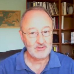
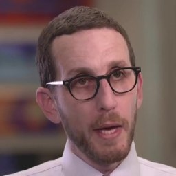
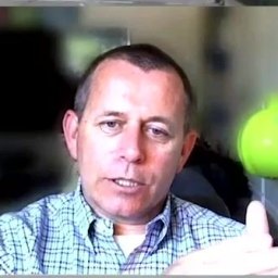
This development is particularly noteworthy because it involves a collaborative effort between experts from diverse fields. Among them are Enzo Signore, the Chief Marketing Officer at Quanergy, a company specializing in the LiDAR technology; Ben Boehme, the Director of Business Development at Sense Photonics (Now Ouster), another firm working in the same domain; Adam Cohen, a Survey Researcher from the Transportation Sustainability Research Center at UC Berkeley, who brings academic insights into the mix; Scott Wiener, the California State Senator representing District 11, offering a legislative perspective; and Paul Hoekstra, an Independent Consultant for the San Francisco Municipal Transportation Agency (SFMTA), who provides practical insights from the city's transportation agency.
This diverse panel of experts, with their unique blend of expertise from the private sector, academia, government, and the municipal transportation authority, provides a comprehensive view of the traffic situation in San Francisco and the potential impact of LiDAR technology in mitigating it. This discussion would be particularly enlightening for urban planners, smart city experts, policy makers, transportation experts, environmentalists, and residents of San Francisco who are directly affected by the traffic issues. It offers a deep dive into how cutting-edge technology can be leveraged to solve real-world problems in urban settings, making it a must-watch for anyone interested in urban development and technology-driven solutions to civic challenges.
Read the transcript machine-generated
More in Mobility
See all 4:11
From Cameras to Insights: VisionAI Transforms Motorway Operations
 6:29
VisionAI Helps Boost Security During 2024 Olympic Games
 8:19
Curbing Noise Pollution with AI-Enabled Solution
 7:29
Brussels’ Smart City Strategy – Part 2
 7:59
Smart Parking Landscape Changes with New Players, Enforcement
 8:13
Mobility Data: New Paradigm for Smart Cities
Latest news in mobility
All news- USDOT Selects UCLA, University Of Michigan And Derq For $5.5M Intersection Safety Phase One25 Oct 2026
- MBTA Begins Hayden AI Bus Lane And Bus Stop Camera Enforcement On Routes SL4 And SL525 Oct 2026
- Los Angeles Council Approves 50 DASH Bus Enforcement Cameras In $3.43M Hayden AI Contract24 Oct 2026
- Allstate’s Arity To Acquire INRIX Assets To Merge Driving And Traffic Data20 Oct 2026
Kurrant advisory
Planning a mobility project? Talk to Kurrant.
Behind these interviews is Kurrant's advisory team, working with utilities, cities and the companies that serve them.
- Strategy AdvisoryKurrant is actively involved in resolving the challenges that cities, utilities and industry players are facing.
- M&A AdvisorySmart city and utility expertise for successful deals, turning insights into strategic gains.
- Engineering & ProcurementBetter engineering and procurement decisions, by identifying and developing digital and IoT solutions across use cases.
Or write to us: contact@kurrant.com
Send us a message