 in Barcelona
 3 to 5 Nov 2026
this is a look at a smart city project underway in philadelphia you know i always joke it's like the least sexy project out there you know it's like oh pavement assessment using ai and machine learning in just three months city -owned cars scan 1200 miles of pavement in search of potholes and cracks in the road using devices like this prior we've sent out teams of individuals to manually expect our 25,000 miles of street. It's a process that otherwise took six months to a year, but now they just put the the device on the vehicle. It's pre-programmed to understand which streets should be inspected. Devices include cameras, a GPS and an accelerometer to measure bumps in the road. And so far these efforts are paying off. A 2021 study that inspected roads nationwide reported that. Philly was ranked number one in. country but a change in perception that's a bit of a longer road when you say the best in the country i really i wonder which country they're talking about you see in philadelphia it's not uncommon to see roads like this they're why mayor jim kenney plans to dedicate 100 million dollars to road repairs over the next two years and technology like the solution from good roads will play a big role in allocating those funds we're really trying to put an equity lens on how we are addressing infrastructure And so we've been working to take this data and overlap it with or overlay it with data around where we've historically invested funds and start to kind of use that as a tool to facilitate conversations around moving forward. Emily Yates is Philadelphia's Smart City Director. She oversees Smart City Philadelphia, which really emphasizes collaboration between the public and private sector. Smart City Philadelphia. to do that by prioritizing resident complaints that have long haunted the city. Trash and the state of the right -of -way and pavement conditions were always a kind of a consistent top issue with the community and so I knew from the get -go that we needed to do something to impact the right -of -way. It also helps that the right-of-way is where everything generally smart cities exist right so when we initially considered a pilot around this it was actually in partnership with our street sweeping pilot. We are one of the few largest cities that don't currently have a street sweeping pilot, and we were about to launch it pre -COVID, and the goal was to find devices that could go in front of these street sweepers and could monitor and quantify the impact of street sweeping. So weekly, it would go back and say, okay, has the trash lessened? Has it increased? And oh, while we're at it, can we assess kind of the current state of just the right Can we map herbicides? Can we map trees? Can we map assets and whatnot? And then COVID hit, our budget got drastically reduced. The street paving was not a priority. And so through a series of conversations internally, we pivoted. To pavement, Philadelphia entered into a deal with Good Roads paying just $30 ,000 for the devices to scan their streets in the surrounding environment, like signs and parking spaces. They have a very low cost. device that currently for pilots can be magnetically attached to the front of a vehicle whether it's a city fleet vehicle or you know heavy duty fleet like trash trucks which in most cities would work in philadelphia where we have parking constantly um we needed to have actual just regular cars uh go up and down the streets um magnetically attaches we had six devices that magnetically attach is it has an accelerometer a gps and a camera and so the camera takes a picture every half second 35 foot wide accelerometer measures kind of the bumps of the road so the condition of the road and also speed of the car and then gps does location so the devices use wi -fi um that you can pair them with your phone so that um we can we can monitor them and communicate with them control them but at the end of the day they've they've recorded over 100 gigabytes of data because it's a cheaper device uh and because We weren't sure about our connectivity citywide necessarily. At the end of the day, the colleague that drove the roads would come into the shop and upload it via the city's network. The collected data is sent to the cloud where the images, inspection data, and ratings are analyzed using AI. Findings are displayed on the Good Road dashboard in a map-based report. That's where city managers can view the entire map, hone in on specific... neighborhoods or display streets that need the most repairs. We do have a quality assurance process so we have a team of humans that will review the results. It's a way we can continue to train our AI at the same time and at the end of that then the results you know we're talking a few days to maybe a week or two depending on the size of the contract the data is in our app. and the city can go to our platform and review the results right there. What we want to explore a little bit more as we move forward in our partnership is the opportunity to assess the right of way. We can't really view it from the street because of the vehicles that are parked. So how do we get these devices on the sidewalks? Is it via drone? Is it via robot? Is it via electric bike? Do we pay somebody to ride the bikes around the city so we can collect this data? And then what data? we want to collect we already do a litter index similar to the pavement it's not the most efficient process because we send people out there to manually inspect so the the quality of the data is not as good as we could get via something like uh this device um but also can we look at things like uh structural integrity of the foundation of buildings because we are a old city we've never had a major fire like new york or chicago where we had have like a rebuild of our housing stock so we have some very old houses here could this be a way to help kind of look at the structural integrity now good roads isn't the only one making an impact in this space by sala road ai uses software installed on cell phones to gather its data and robotics uploads footage from drones gopros and other cameras to power its ai platform but good roads is different from those others in that it offers a hardware and software solution, and the company is now investigating ways to add edge computing to its device. For more coverage on how this project unfolds and other smart city projects in Philadelphia, be sure to stick with Current Insights. And if you have a question or comment, be sure to hit the button below. Thank you. Thank you.
Philadelphia Uses AI to Speed Up Road Inspections
AI & Computer VisionMobilityPhiladelphiaRoad monitoring
In this video
-
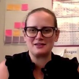 Emily Yates
Smart City Director, City of Philadelphia
-
 Chris Sunde
Founder, GoodRoads.io
About this video
The video presents an engaging exploration of Philadelphia's innovative approach to addressing the perennial issue of potholes on city roads. The city, having recently secured a substantial budget for road repairs, is turning to modern solutions to expedite and improve the process. Central to this initiative is an artificial intelligence (AI) solution developed by GoodRoads, a company at the forefront of leveraging technology for urban infrastructure maintenance.
Emily Yates, the Smart City Director at City of Philadelphia, delves into the origins and objectives of this project. Her insights shed light on how the city recognized the need for a more efficient, technology-driven approach to road maintenance. Yates discusses the challenges of traditional methods and the advantages offered by the AI solution in assessing pavement conditions more accurately and promptly. This not only promises to enhance the quality of road repairs but also aims to optimize resource allocation and planning.
The video also features an interview with Chris Sunde, the founder of GoodRoads. Sunde offers an in-depth perspective on his company's vision and the technology behind the AI solution. He explains the functionality of the system, focusing on its ability to analyze vast amounts of data to identify areas most in need of repair. The discussion with Sunde reveals the potential of such technology to revolutionize urban infrastructure management, not just in Philadelphia but potentially in other cities facing similar challenges.
This video is particularly relevant for city planners, urban development professionals, and technology enthusiasts interested in smart city innovations. It offers practical insights into how AI can be effectively integrated into urban management to solve long-standing issues like road maintenance. Viewers will gain an understanding of the collaborative efforts between municipal authorities and tech companies in driving urban development forward.
Read the transcript machine-generated
More in Mobility
See all 4:11
From Cameras to Insights: VisionAI Transforms Motorway Operations
 6:29
VisionAI Helps Boost Security During 2024 Olympic Games
 8:19
Curbing Noise Pollution with AI-Enabled Solution
 7:29
Brussels’ Smart City Strategy – Part 2
 7:59
Smart Parking Landscape Changes with New Players, Enforcement
 8:13
Mobility Data: New Paradigm for Smart Cities
Latest news in mobility
All news- Natal Starts Installing Adaptive Traffic Signals On Avenida Prudente De Morais21 Nov 2026
- Slovak Road Administration Renews Vaisala Road Weather Station Maintenance20 Nov 2026
- SFMTA Picks Hayden AI To Replace Muni Bus Lane Cameras On 212 Buses20 Nov 2026
- STASY Awards Dotsoft €1.09M Contract For Smart Parking At Four Athens Metro Stations20 Nov 2026
Kurrant advisory
Planning a mobility project? Talk to Kurrant.
Behind these interviews is Kurrant's advisory team, working with utilities, cities and the companies that serve them.
- Strategy AdvisoryKurrant is actively involved in resolving the challenges that cities, utilities and industry players are facing.
- M&A AdvisorySmart city and utility expertise for successful deals, turning insights into strategic gains.
- Engineering & ProcurementBetter engineering and procurement decisions, by identifying and developing digital and IoT solutions across use cases.
Or write to us: contact@kurrant.com
Send us a message