in Barcelona
 3 to 5 Nov 2026
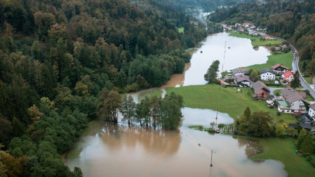
Civil Security Hub Poland (CS Hub PL), the crisis-intelligence node operated in Warsaw by the Crisis Information Centre (CIK) of the Space Research Centre of the Polish Academy of Sciences (CBK PAN), has signed a subscription with synthetic aperture radar (SAR) satellite operator ICEYE for flood, wildfire and river ice monitoring, the two organisations announced on 12 November 2026. The agreement, placed under the European Space Agency’s European Resilience from Space for Earth Observation (ERS-EO) initiative, gives Polish emergency services standing access to ICEYE data rather than requiring a separate activation for each incident.
A Subscription Model For Poland’s Emergency Services
CS Hub PL combines satellite data, drone imagery and analyst expertise into products for the State Fire Service, regional crisis management teams and hydrological services, and it was initiated by CIK together with cloud provider CloudFerro, ICEYE, the Warsaw University of Technology and the European Space Foundation, according to the joint release. The European Space Foundation describes the hub as the first entity of its kind in Europe under ESA’s Space Resilience Nodes initiative, which belongs to the agency’s European Resilience from Space programme.
The subscription structure moves satellite flood mapping from an emergency purchase made once water is already rising to a pre-contracted service that crisis teams can draw on before, during and after an event. Partner countries can also request support from Polish node teams, according to Milmag’s report on the agreement.
Three Flood Products, A Wildfire Pilot And River Ice Trials
The core of the contract is ICEYE’s Flood Solutions Suite. Flood Early Warning forecasts large-scale flooding up to four days ahead, Flood Rapid Impact maps flood extent within hours of an event and refreshes as often as every three hours, and Flood Insights delivers observed flood extent, water depth and building-level impact data within 24 hours of the flood peak, with daily updates thereafter.
The wildfire component runs as a pilot service that combines thermal detection from German satellite operator OroraTech with radar and optical satellite data, so that active fires can be tracked, building damage assessed through smoke or at night, and burned areas mapped once the fire is out. SAR sensors image through cloud, rain, smoke and darkness, which is the operational reason for pairing them with thermal and optical sources that lose visibility under those conditions.
A third service, river ice monitoring, will be validated in Poland during the winter and spring seasons to track ice formation and movement and to identify conditions that could lead to ice-jam flooding on Polish rivers.
The Storm Boris Precedent
The agreement formalises a working relationship tested during Storm Boris in September 2024, when ICEYE flood data was delivered to CIK and passed on to the State Fire Service, regional and local crisis teams and the national hydrological and meteorological service IMGW-PIB. Flood Rapid Impact was the primary flood information source during the first four days of that event, according to the release, and the services had been developed with ESA and CBK PAN under the COSMOS project, part of ESA’s Civil Security from Space initiative, before being adapted for Polish users through the hub’s Innovation Pipeline-as-a-Service model.
The scale of that flood explains the demand for faster mapping. In September 2025 the Polish government said the clean-up and support measures following the 2024 floods had cost more than PLN 8 billion, about €1.9 billion, spread across nearly 30 support programmes, according to Polskie Radio.
Andy Read, Vice President, Government Solutions at ICEYE, said in the 12 November 2026 release that “Poland, working with ESA, has shown how a Space Resilience Node works in practice”, describing CS Hub PL as a model for nodes elsewhere in Europe.
ICEYE’s Expanding Polish And Civil Portfolio
ICEYE, which describes itself as a Polish-Finnish company, has launched more than 80 SAR satellites, employs over 1,500 people and has captured and analysed more than 600 flood events worldwide, all figures supplied by the company. Its defence relationship with Warsaw is larger than the civil contract: the Polish Ministry of National Defence signed a deal worth about €200 million for SAR satellites, and ICEYE delivered four satellites and constellation control to the Polish armed forces in less than 12 months from signature, as reported by Via Satellite in May 2026.
On the civil side, the Poland agreement follows a run of public-sector flood and wildfire contracts. Kurrantly reported in June 2026 that the Norwegian Water Resources and Energy Directorate selected ICEYE for nationwide SAR flood monitoring covering mainland Norway and Svalbard, and in October 2026 that the California Governor’s Office of Emergency Services integrated ICEYE flood and wildfire products into its operations. The company closed a €450 million Series F round at a valuation above €10 billion in June 2026, giving it capital to keep expanding the constellation that feeds these services.
Market Context: Satellite Data Becomes Routine Civil Protection Infrastructure
Public buyers have traditionally accessed satellite flood maps through the Copernicus Emergency Management Service, which is activated event by event, so a national subscription of this kind signals a shift toward treating commercial radar data as standing infrastructure alongside river gauges and weather radar.
The Next Test: Winter Ice And The Next Flood Season
The first operational milestone is the river ice validation that runs through the coming winter and spring, which will show whether SAR monitoring can give Polish crisis managers usable lead time on ice-jam flooding. The benchmark for the flood services is the Storm Boris performance, when Flood Rapid Impact served as the main information source for four days, and the forecast window of up to four days in Flood Early Warning is the metric that the State Fire Service and IMGW-PIB will measure against their own hydrological forecasts when the next major flood arrives.