in Barcelona
 3 to 5 Nov 2026
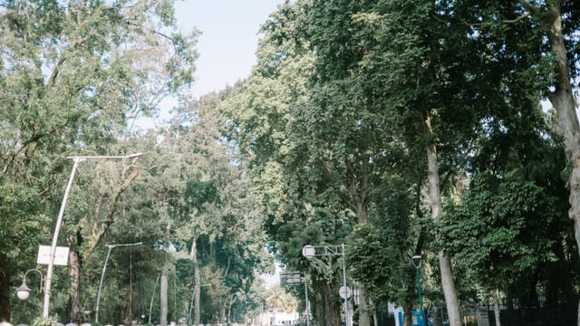
Jerusalem Municipality has completed a pilot that mapped public trees in the Ramot and Rehavia neighbourhoods with a vehicle-mounted laser scanner and cameras, Kol Ha’ir reported on 17 November 2026. The survey, run by the city’s parks and landscape department, used the platform of greehill, a company that makes tree inventory and management software, with Yuval Aricha Environmental Solutions as its Israeli representative.
Why: Safety And Maintenance Planning
The city says the main use is safety. Data on each tree’s health and stability is meant to let staff identify diseased or unstable trees early and prioritise pruning or removal, particularly ahead of the winter storm season.
The municipality also wants to plan staff, resources and budgets for tree maintenance from an accurate count of its trees and their condition. Mayor Moshe Lion said the survey gives the city its first accurate and comprehensive picture of every tree, and helps it plan treatment and maintenance more efficiently.
Traditional tree surveys require inspectors to visit and measure each tree by hand. In this pilot, a vehicle drove the streets with a laser scanner and six cameras, recording each tree from several angles and producing 360-degree imagery.
What The Data Contains
Processing the scans is expected to take 8 to 10 weeks from the survey date. After it is complete, each tree in the surveyed areas is to have a 3D digital model with its exact location, species, height, crown spread and trunk diameter. Around 70 further indicators cover health, vitality and stability.
The platform also includes tools to assign maintenance tasks, file reports and attach photos from the field, so each treatment can be tracked. greehill says it estimates carbon storage and the environmental contribution of each tree. All data belongs to the city and can be exported to its GIS and planning systems.
Other Cities Using The Method
greehill says its technology is used in more than 130 cities. These include Singapore, where it works with the National Parks Board; Rome, where its first large survey covered about 85,000 street trees; Strasbourg; and Lisbon. In the US, Plymouth, Minnesota, scanned about 40,000 trees, and Bloomington and Denton in Texas adopted the method in 2023, according to the company.
What Happens Next
The final data for Ramot and Rehavia is due once processing and validation are complete, which the city expects 8 to 10 weeks after the scan. The municipality says it intends to extend digital tree records across the city.