in Barcelona
 3 to 5 Nov 2026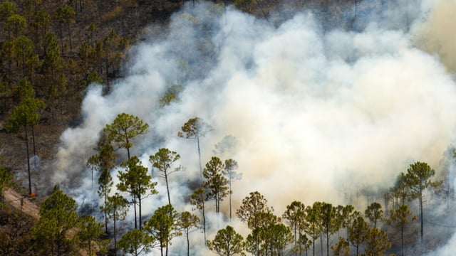
The Alabama Forestry Commission (AFC), the state agency responsible for wildfire protection across nearly 23 million acres of forestland, has deployed OroraTech’s Wildfire Solution satellite monitoring platform statewide. The move was announced on September 30, 2026. The platform will support both wildfire response and the monitoring of prescribed burns, and combines data from OroraTech’s 19 proprietary thermal-imaging satellites with feeds from more than 20 public satellites. Wildfires had burned more than 30,000 acres in Alabama by mid-September 2026, against about 35,000 acres in all of 2025 and nearly 21,000 acres in 2024. The contract value has not been disclosed.
A Drought Year That Tested Ground-Based Detection
Alabama’s 2026 fire season was concentrated in spring. Wildfires had burned 29,116 acres across about 2,000 fires by early May, according to the season’s public record, led by a 2,500-acre fire in Shelby County that burned from late March to mid-April.
The AFC issued a statewide fire alert in April as drought conditions worsened, after urging caution during the prescribed burn season in February. Debris burning and arson are among the leading historical causes of fires in the state. In fiscal year 2024, the AFC suppressed 1,731 fires covering 34,010 acres on a state forestry budget of $21,728,209 from all sources, according to the US Forest Service’s 2025 state fact sheet, which gives a sense of the workload a detection layer is meant to make more efficient.
Detection in a largely private, forested state has traditionally depended on fire towers, aerial patrols and public reports. That leaves gaps at night and in remote tracts, which is where a satellite layer is meant to add coverage.
“The sooner we know where a fire is, the sooner we can get resources headed that way,” said John Goff, Director of the AFC’s Protection Division, in the agency’s September 2026 announcement.
Watching Prescribed Burns As Well As Wildfires
The prescribed burn use case sets Alabama apart from most earlier OroraTech deployments in the western United States. Alabama treats about one million acres a year with prescribed fire, most of it on private land, according to the governor’s March 2026 proclamation of Prescribed Fire Awareness Month.
At that scale, the agency has to tell permitted burns apart from new ignitions, and to spot planned burns that escape their boundaries. Thermal satellite detections give the AFC a statewide view of active heat sources that can be checked against burn permits, so that responders are not dispatched to controlled fires while escapes are caught earlier.
State Forester Rick Oates said in the announcement that adopting the technology would help the agency detect and respond to wildfires more efficiently while improving safety for firefighters and residents.
How OroraTech’s Constellation Works
OroraTech, a 2018 spin-off of the Technical University of Munich, operates a constellation of small satellites carrying thermal infrared cameras designed to detect heat signatures from fires. Its US subsidiary, OroraTech USA, is headquartered in Denver.
The company’s own fleet now numbers 19 satellites, including four launched in May 2026 for Greece’s national fire system. It plans a constellation of about 35 thermal satellites, according to company and launch records, with the next satellite scheduled for October 2026.
Its Wildfire Solution platform merges those proprietary detections with data from public Earth observation satellites into near-real-time alerts and fire spread modelling. The more satellites in orbit, the more often any point on the ground is revisited, which determines how quickly a new fire can be spotted from space. The company also supplies thermal data to the European Copernicus Emergency Management Service and has been selected for NASA’s Commercial SmallSat Data Acquisition programme, giving it public-sector references on both sides of the Atlantic.
Thomas Gruebler, OroraTech’s co-founder and chief executive of OroraTech USA, said in the announcement that the company intends to work closely with fire management agencies to keep developing its products and satellite technology, which positions state customers such as Alabama as sources of operational feedback as well as revenue.
OroraTech’s growth has been backed by a Series B round of €25,000,000 in October 2024 and a further €12,000,000 extension in May 2025, both reported by Kurrant.
A Growing List Of US Public Customers
Alabama joins a series of US agencies adopting the same platform. In September 2025, Idaho became the first US state to deploy statewide satellite wildfire detection through OroraTech’s Wildfire Solution, under its Department of Lands.
At county and district level, Larimer County, Colorado launched a pilot in 2025. In July 2026, the Aspen Fire Protection District extended coverage into the remote Lincoln Creek Valley.
Alabama is the first southeastern state among these publicly announced deployments, and the first to frame the platform explicitly around prescribed fire. The Southeast burns far more land intentionally each year than the western states where satellite detection has mostly been sold so far.